Decoding Kanazawa: A Vertical Walk Through the Samurai History and River Terraces of Ishibiki & Kodatsuno
Walking the Contours of the Kaga Hyakumangoku※ Legacy
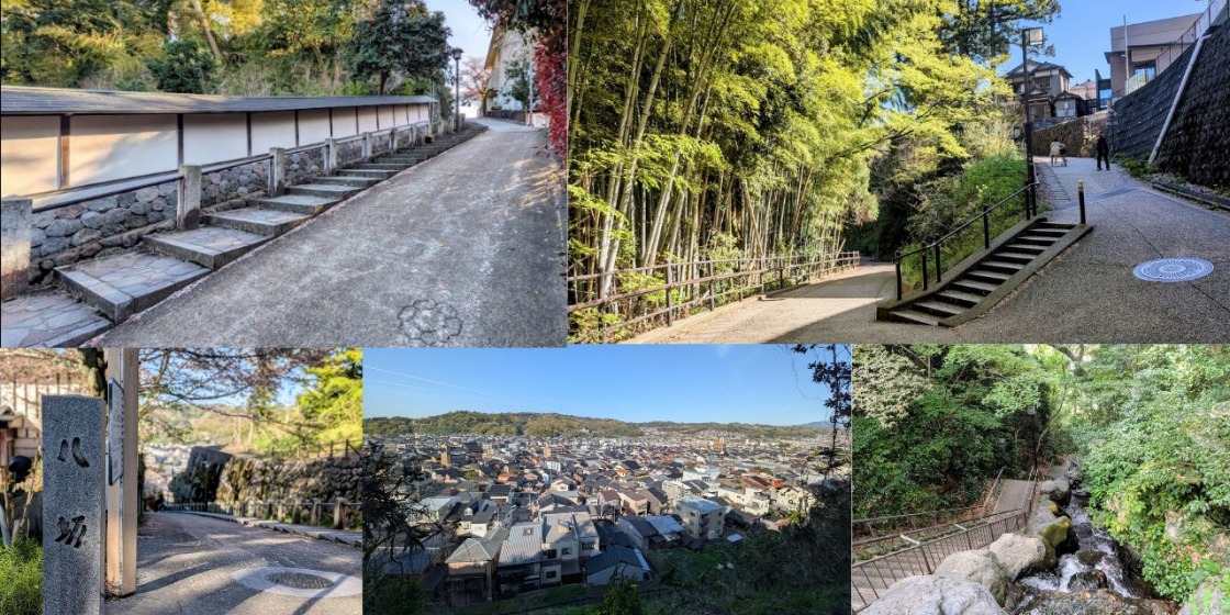
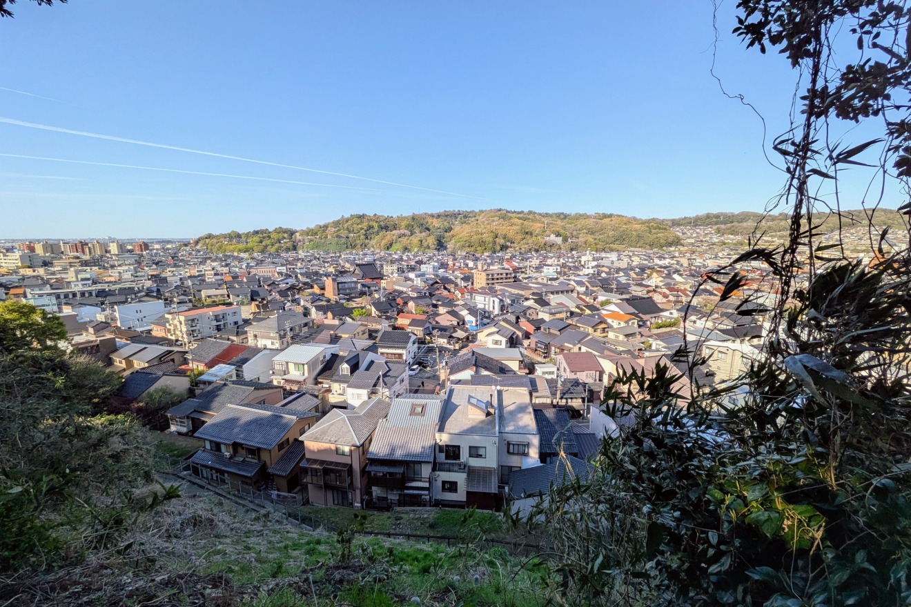
Kanazawa is a "3D Castle Town." Its history is etched into the landscape through a countless network of slopes and cliffs that bridge the high plateaus with the lowlands. Each path has a name and a memory—some whispering of daily life, others revealing the clever military strategies of a bygone era.
The Ishibiki and Kodatsuno areas offer the densest concentration of this topographical drama. By "reading" the terrain as you walk, you will discover a side of Kanazawa that simple sightseeing often misses.
※Note: What is "Kaga Hyakumangoku"?
You will often hear Kanazawa referred to as "Kaga Hyakumangoku" (Kaga's Million Koku).
"Kaga" is the historical name of the province (now part of Ishikawa Prefecture) where Kanazawa is located.
"koku" was a unit of rice used to measure wealth and power. The Maeda Clan, who ruled this area, was the wealthiest and most powerful daimyo (feudal lord) under the Shogun, boasting a massive 1-million-koku yield. This wealth funded the incredible gardens, crafts, and architecture you see today.
Decoding the Giant "River Terraces"
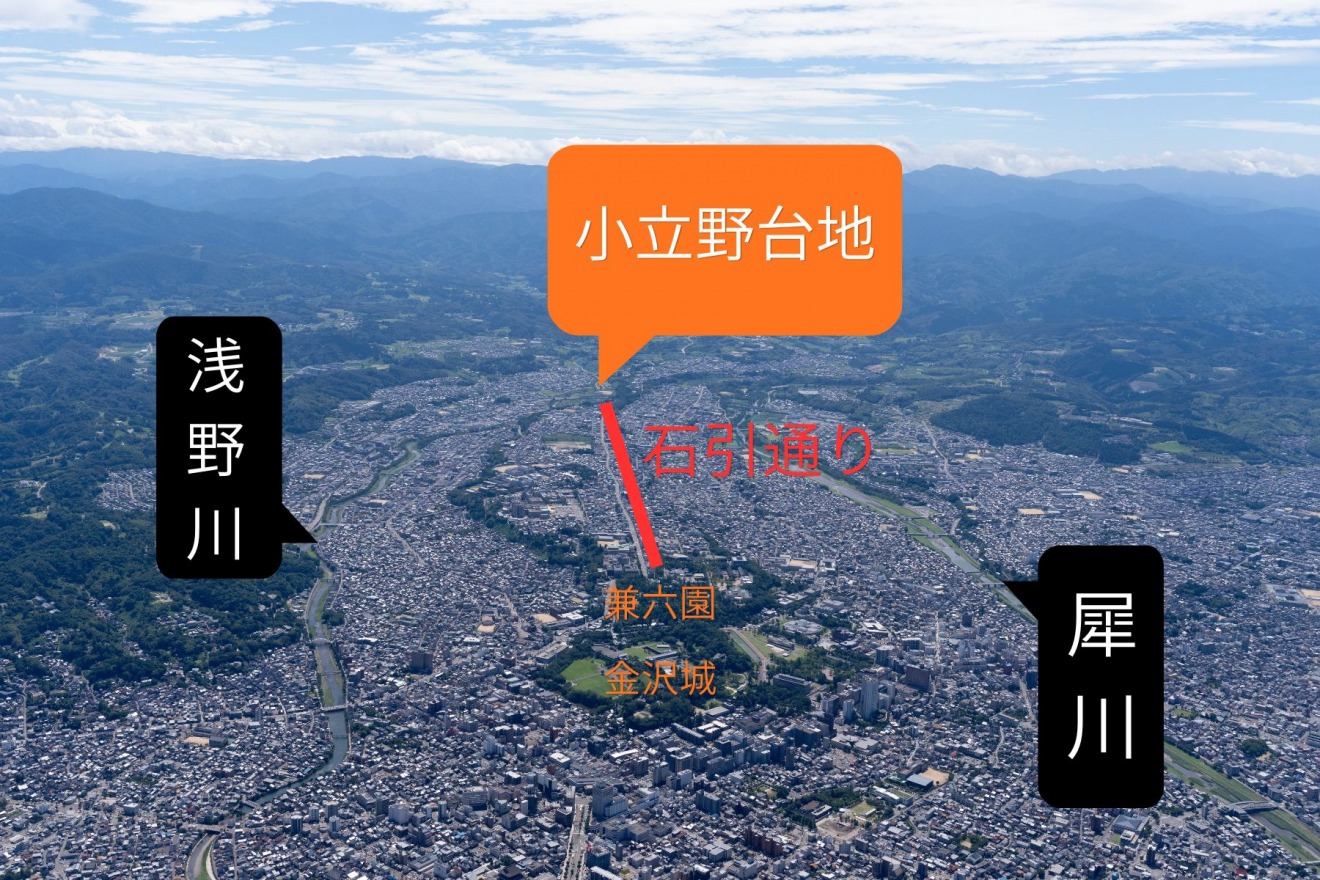
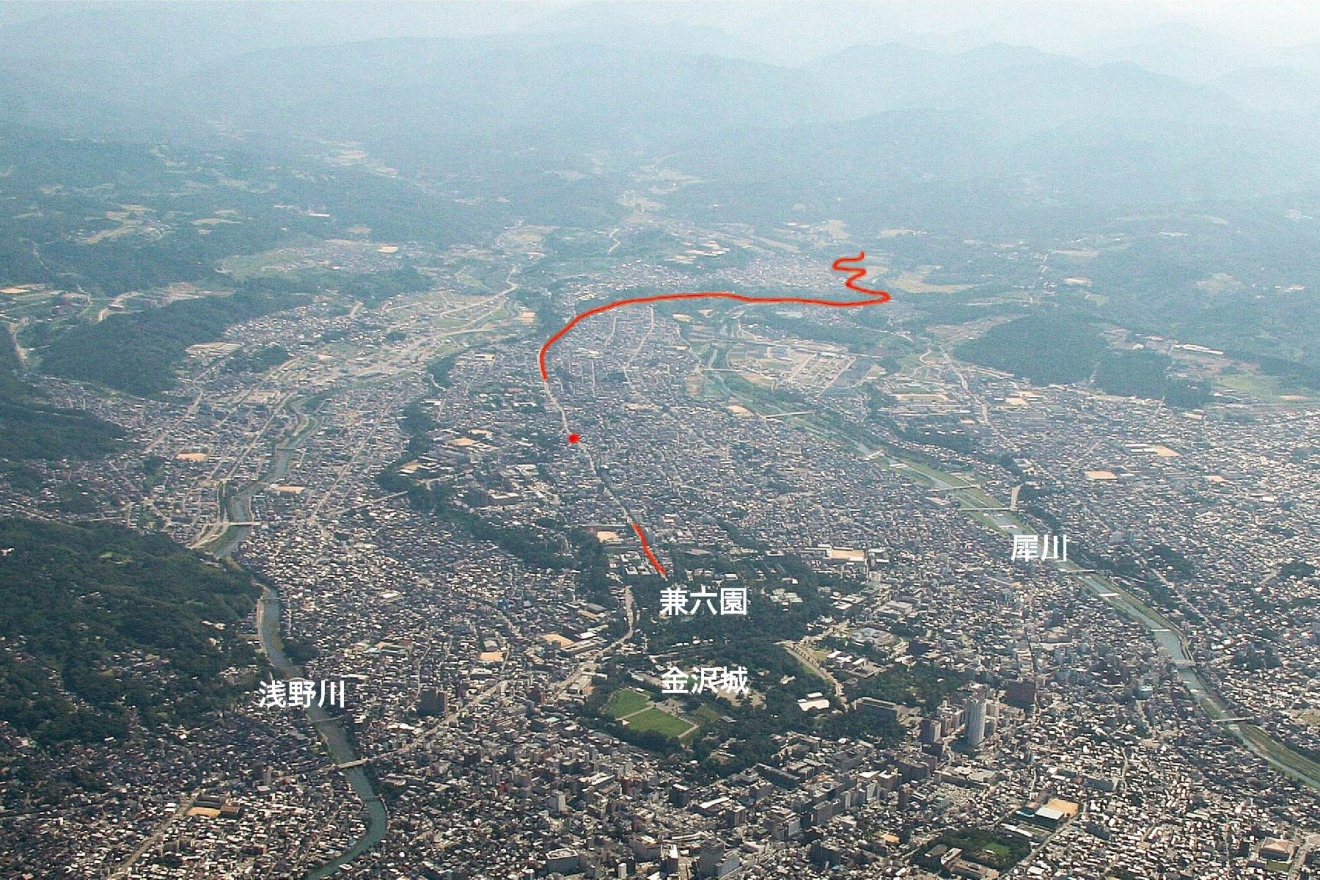
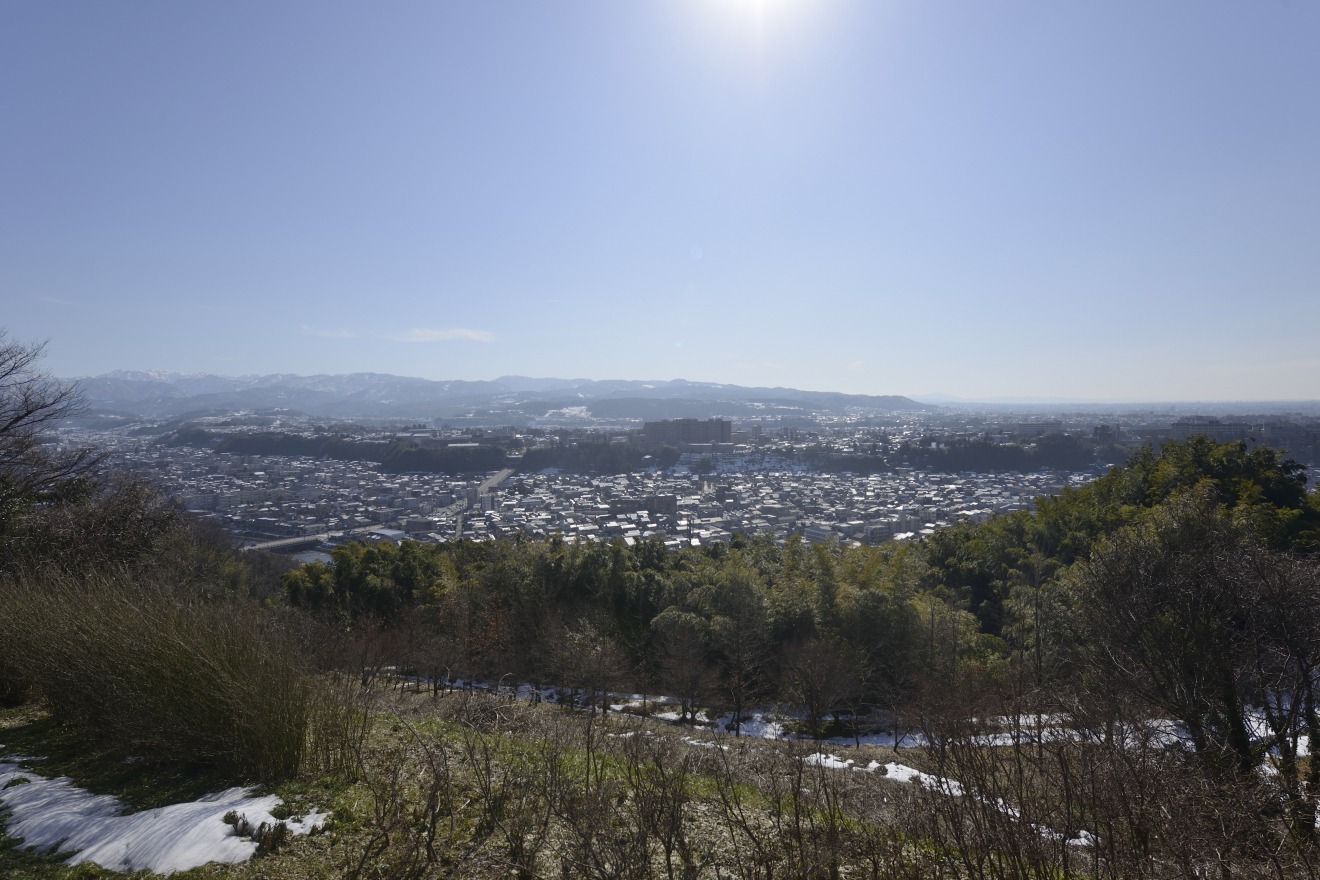
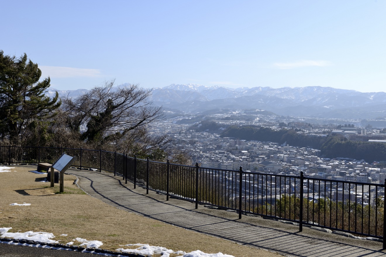
The Kodatsuno Plateau and the Wisdom of Castle Defense
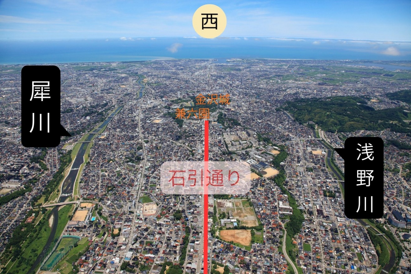
The skeletal frame of Kanazawa was carved by two rivers: the Sai River and the Asano River. Over millennia, they eroded the earth to create "river terraces"—steep steps in the land.
・The "Tongue": Kanazawa Castle sits on the narrow tip of a plateau that juts out like a tongue toward the rivers.
・The "Backbone": The Ishibiki and Kodatsuno areas form the ridge of this plateau, gently rising toward the southeast.
The Kaga Domain turned this natural geography into a masterpiece of defense. The rivers acted as moats, and the steep cliffs served as shields. For an enemy, reaching the castle meant crossing a river and then scaling a vertical cliff.
The Strategy of Elevation
The high ground behind the castle was a potential weakness; if an enemy occupied it, they could look down into the castle. To solve this, the Lords of Kaga lined the edge of the plateau with powerful temples and the massive estates of their top advisors, turning the entire city into a defensive fortress.
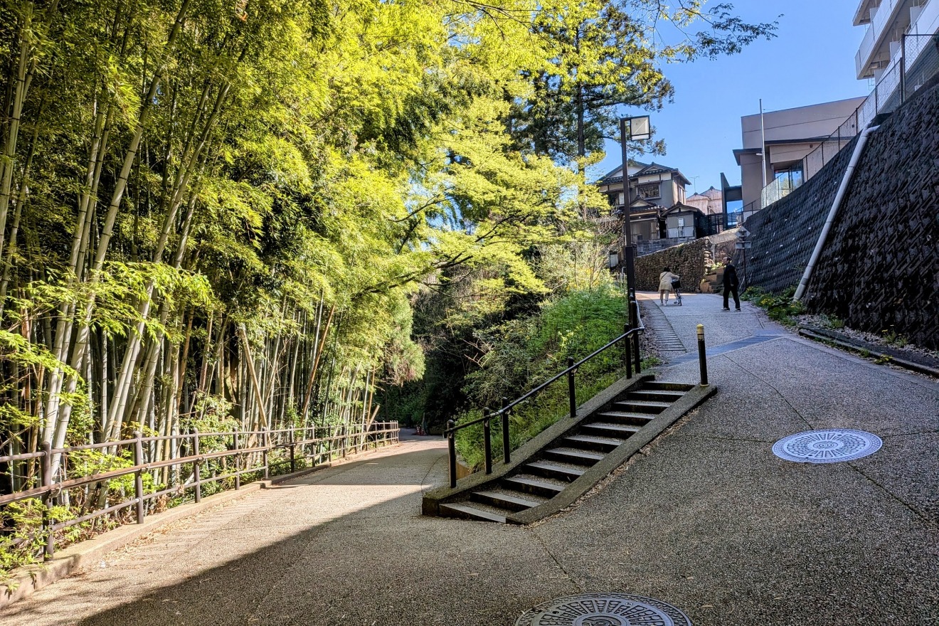
The Ishibiki Street: Memories of Castle Building
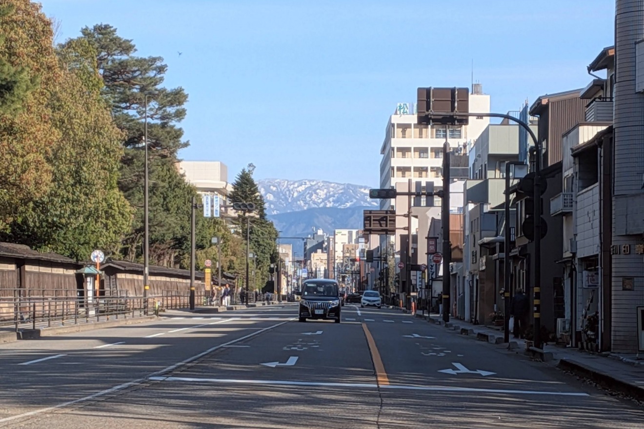
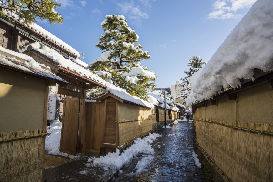
The name Ishibiki (literally "Stone Pulling") is a living record of the city's construction. During the great renovation of Kanazawa Castle in 1592, massive stones were quarried from Mt. Tomuro. Thousands of workers hauled these giant rocks by hand along this very road.
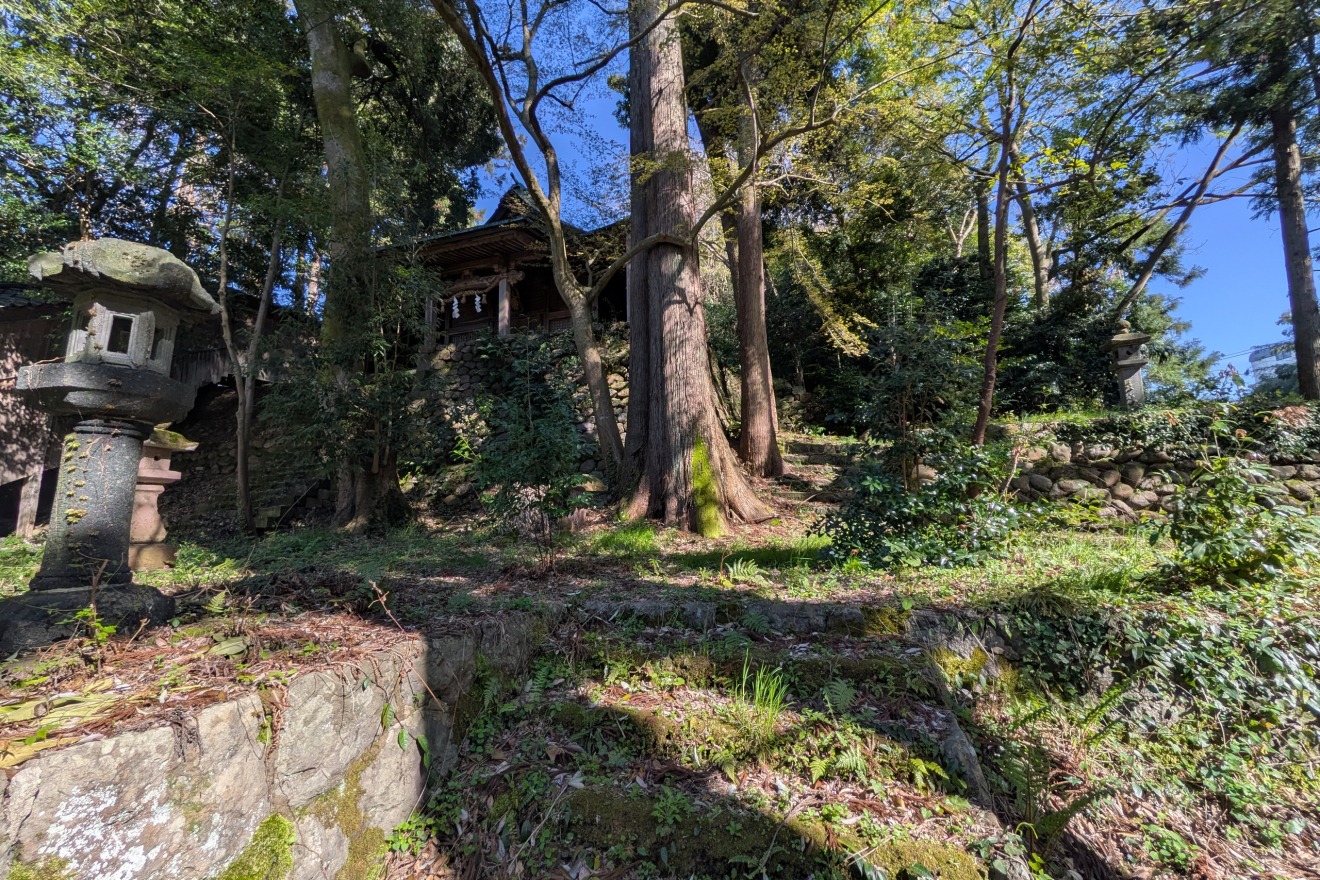
Kodatsuno Temple Grove: Where Prayer Meets Protection
Between around 1615 and 1644, the 3rd Lord, MAEDA Toshitsune, consolidated temples from across the city into three districts. One of these is the ”Kodatsuno Temple Grove".
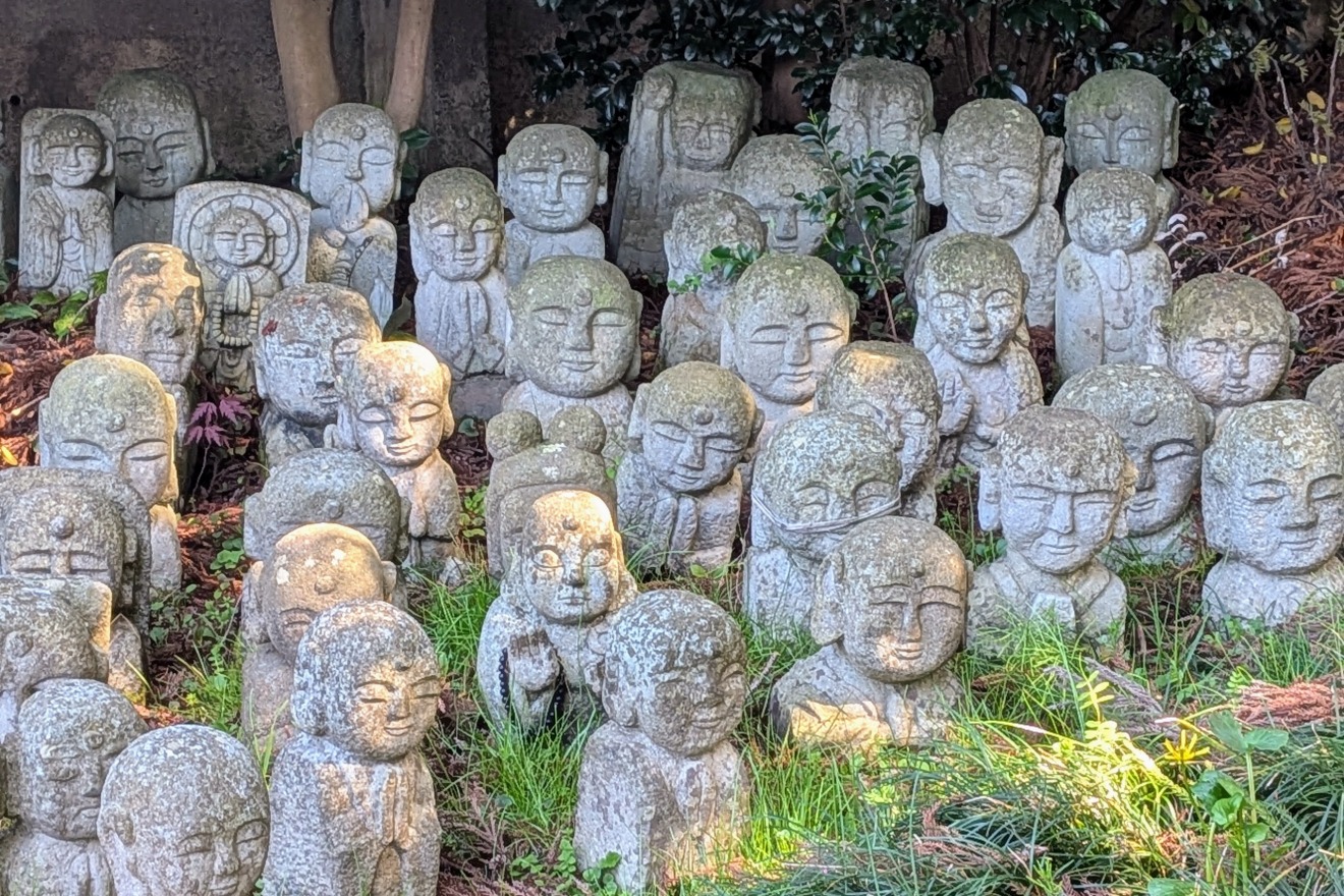
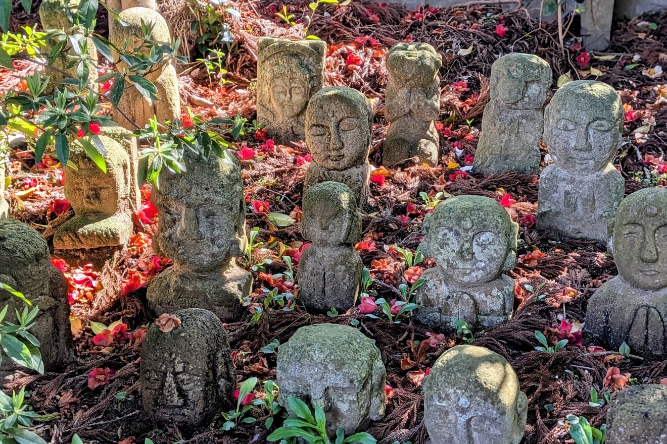
It features temples with deep ties to the Maeda clan and the Tokugawa Shogunate, as well as the family temples of the Kaga Hakka (the eight highest-ranking retainer clans). Today, about 40 temples remain, creating a dignified atmosphere of lush greenery and solemn architecture.
The Samurai’s Commute: Bijutsu-no Komichi (Art Path)

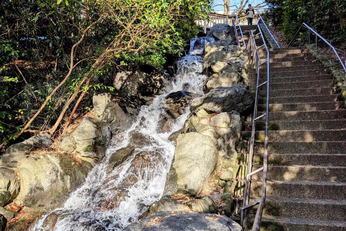
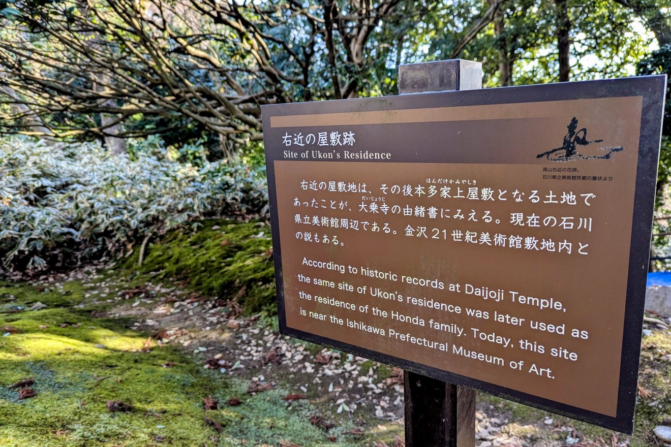
In the Honda no mori (The Woods of the Honda Clan)district, where the Prefectural Art Museum stands today, was once the sprawling upper estate of the Honda clan, the top-ranking retainer to the Maeda clan.
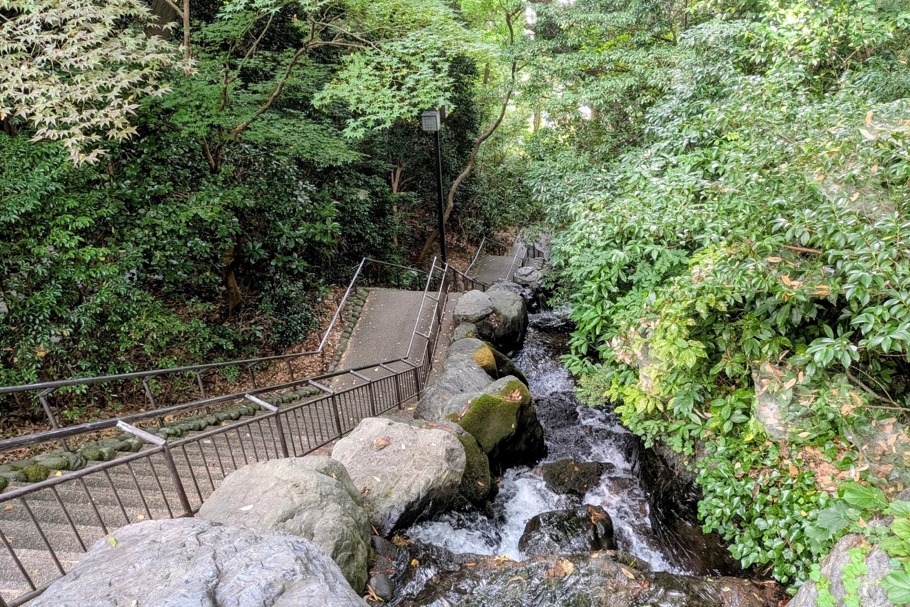
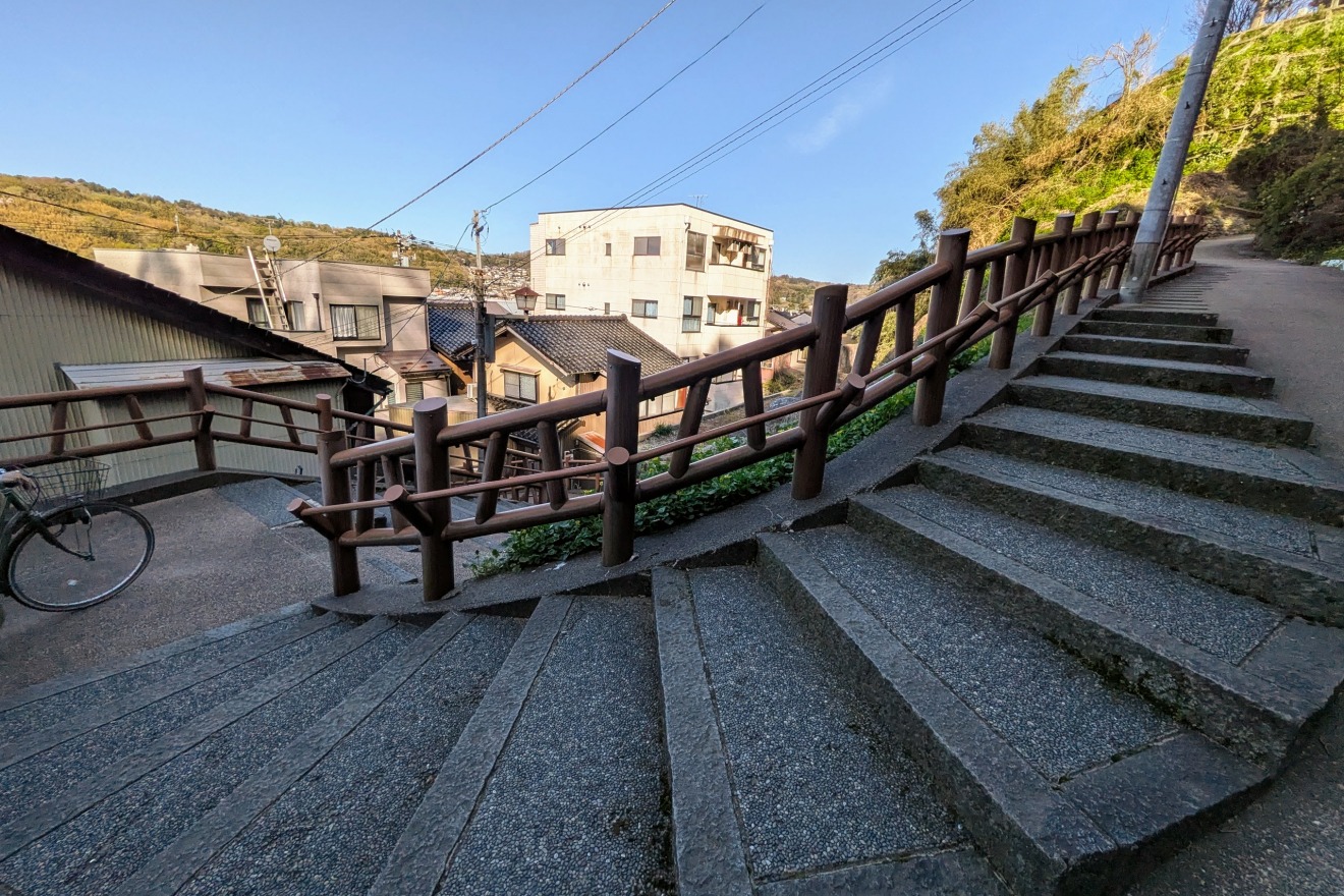
The Samurai Path: The steep stairs leading down the cliff were the daily commute for samurai. Lower-ranking retainer living below the cliff had to climb this grueling slope every morning to reach the master's estate.
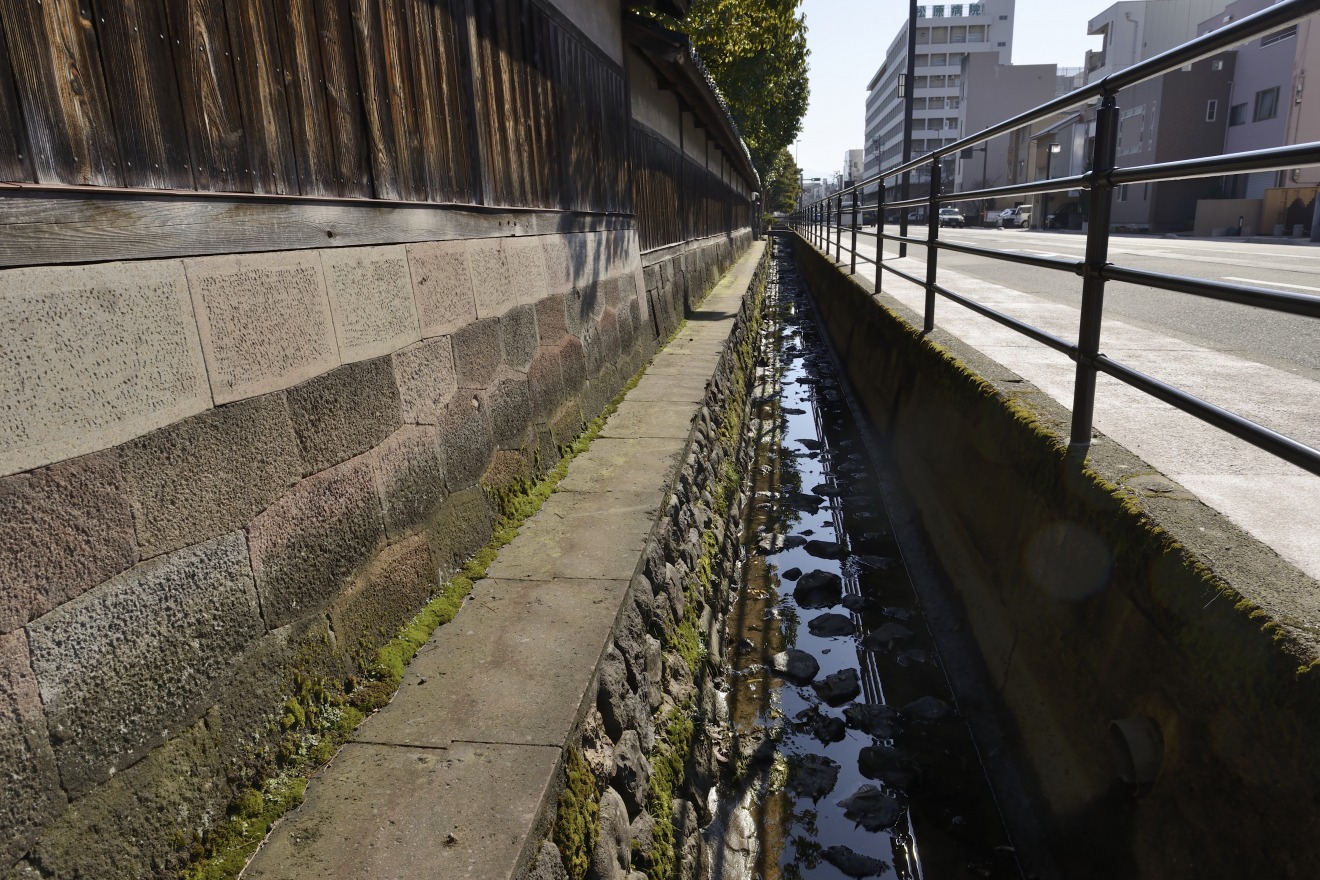
The Sound of History: Beside the stairs, you’ll hear the rushing water of the Tatsumi Canal, a 17th-century engineering marvel. The sound provides a "natural air conditioner" during the humid summer months.
Zen and the Landscape: D.T. Suzuki Museum:
Located in the lowlands at the foot of the cliff, you will find the D.T. Suzuki Museum, dedicated to the world-renowned Buddhist philosopher. Suzuki was born into a family that served the Honda clan and grew up amidst these very slopes. It is said that this dramatic verticality influenced his deep philosophical meditations.
Topography Data:
・Upper plateau (Art Museum): Approx. 47m elevation
・Lower terrace (D.T. Suzuki Museum): Approx. 26m elevation
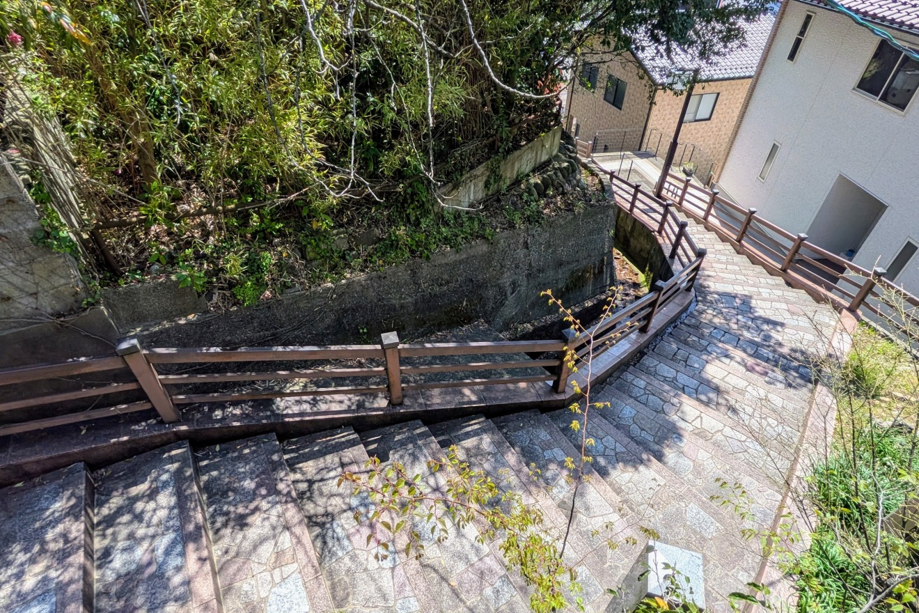
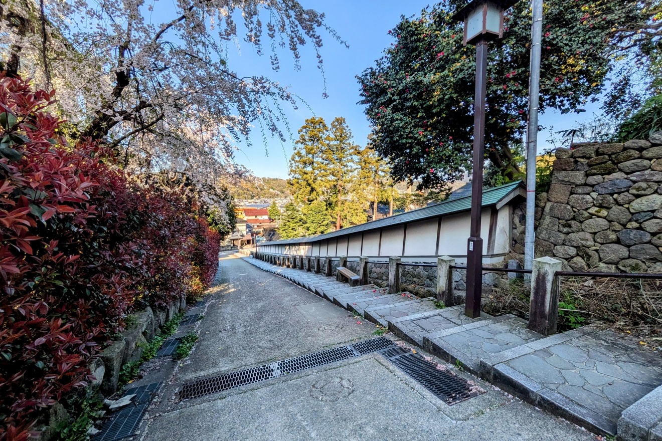
Daijoji Temple Slope — A Stairway of Stone Walls and Sharp Turns
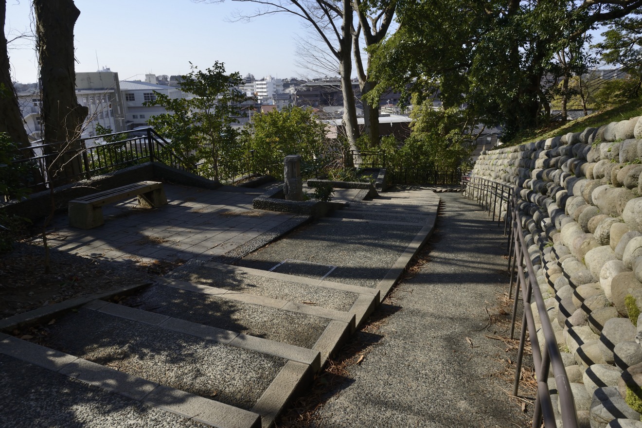
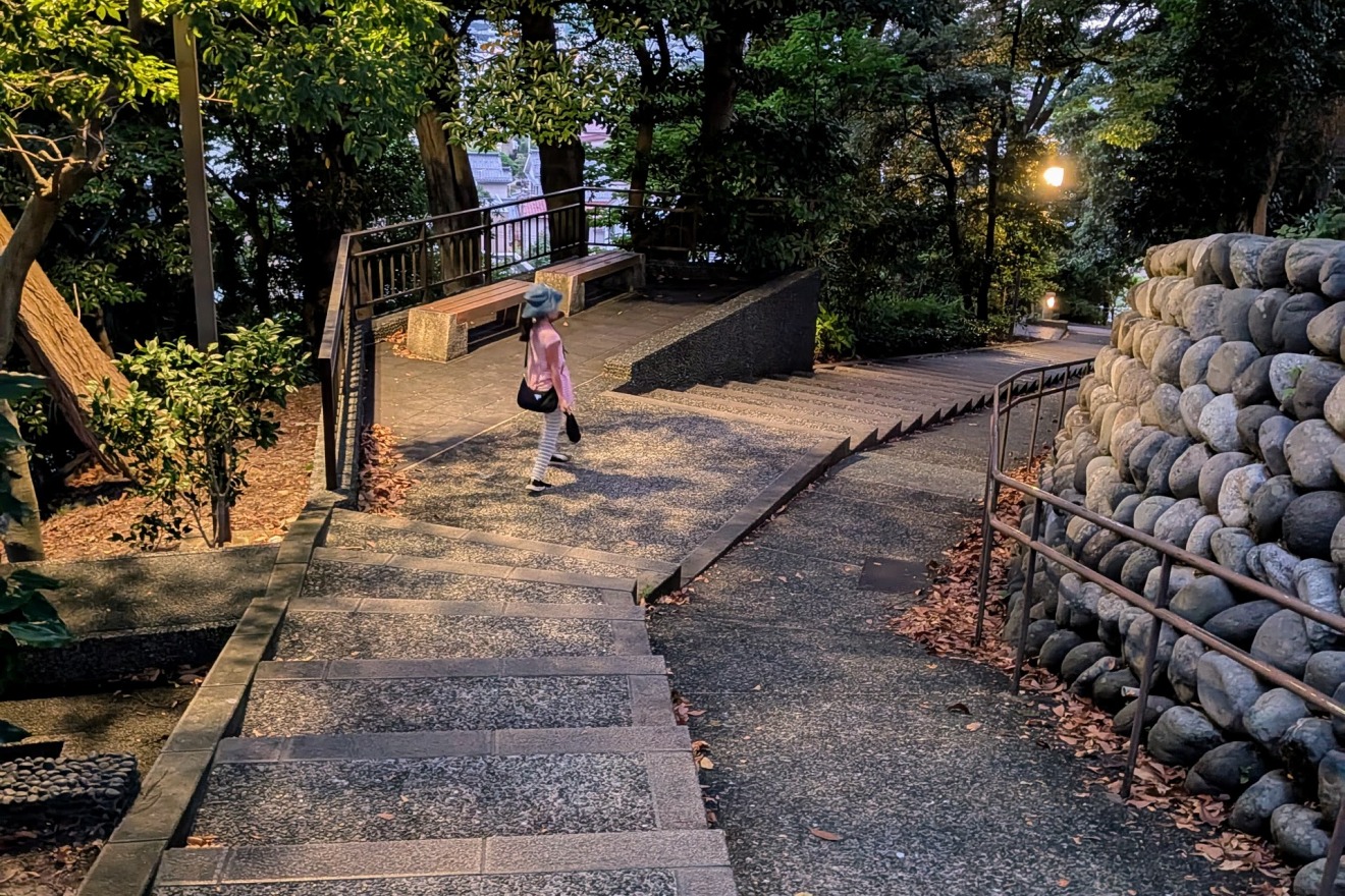
A long and beautiful stone stairway connecting the lower district of Hondamachi with the upper plateau of Ishibiki, this slope takes its name from the former Daijoji Temple, which once stood at its base before relocating to Nodayama.
The path bends in a deliberate zigzag along the stone walls.
As you climb step by step, the townscape of Hondamachi below gradually falls away behind you. That slow, unfolding sense of rising height is one of this slope's unique pleasures.
Topography Data:
Top of Daijoji Temple Slope: approx. 51m elevation
Bottom of Daijoji Slope: approx. 28m elevation
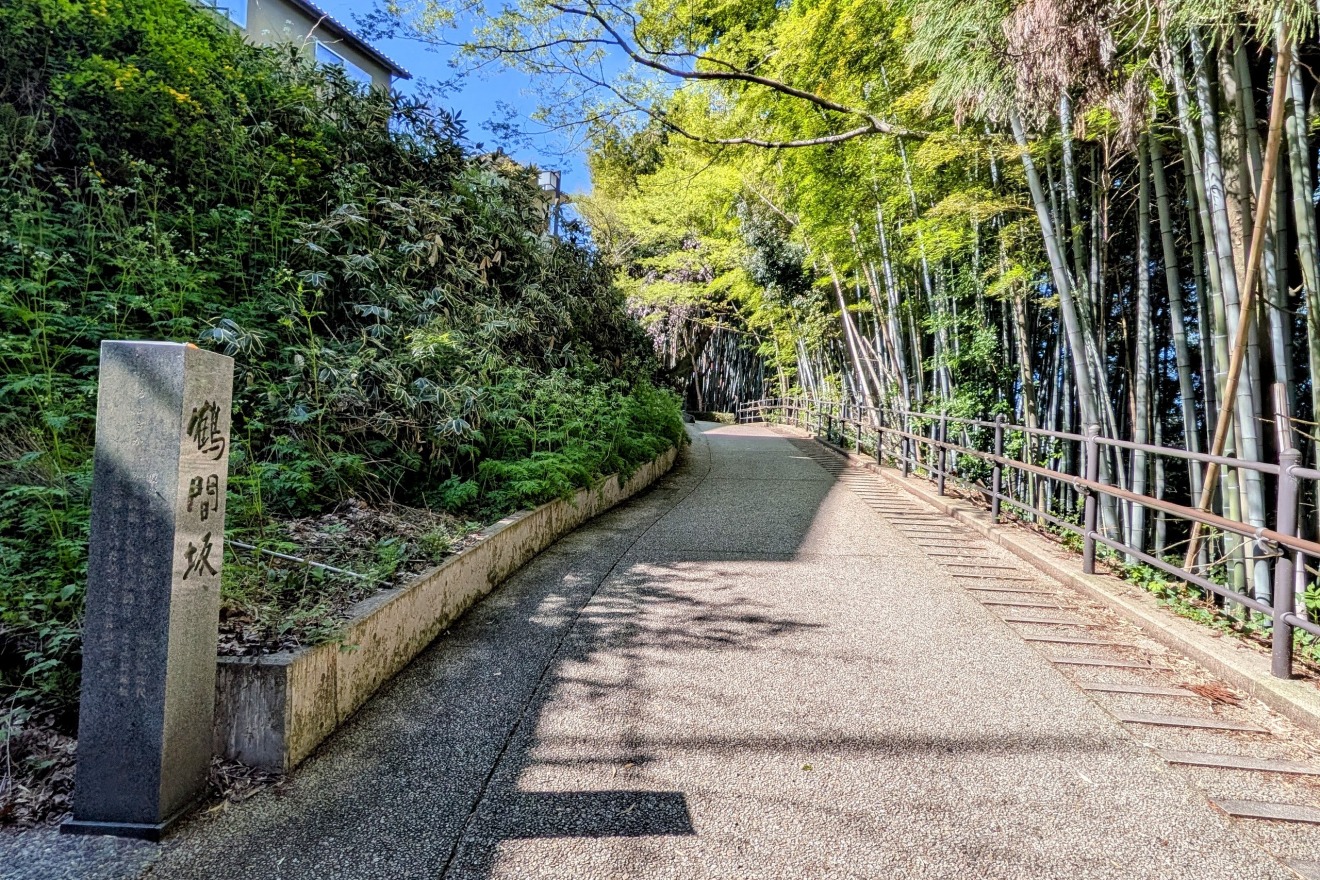
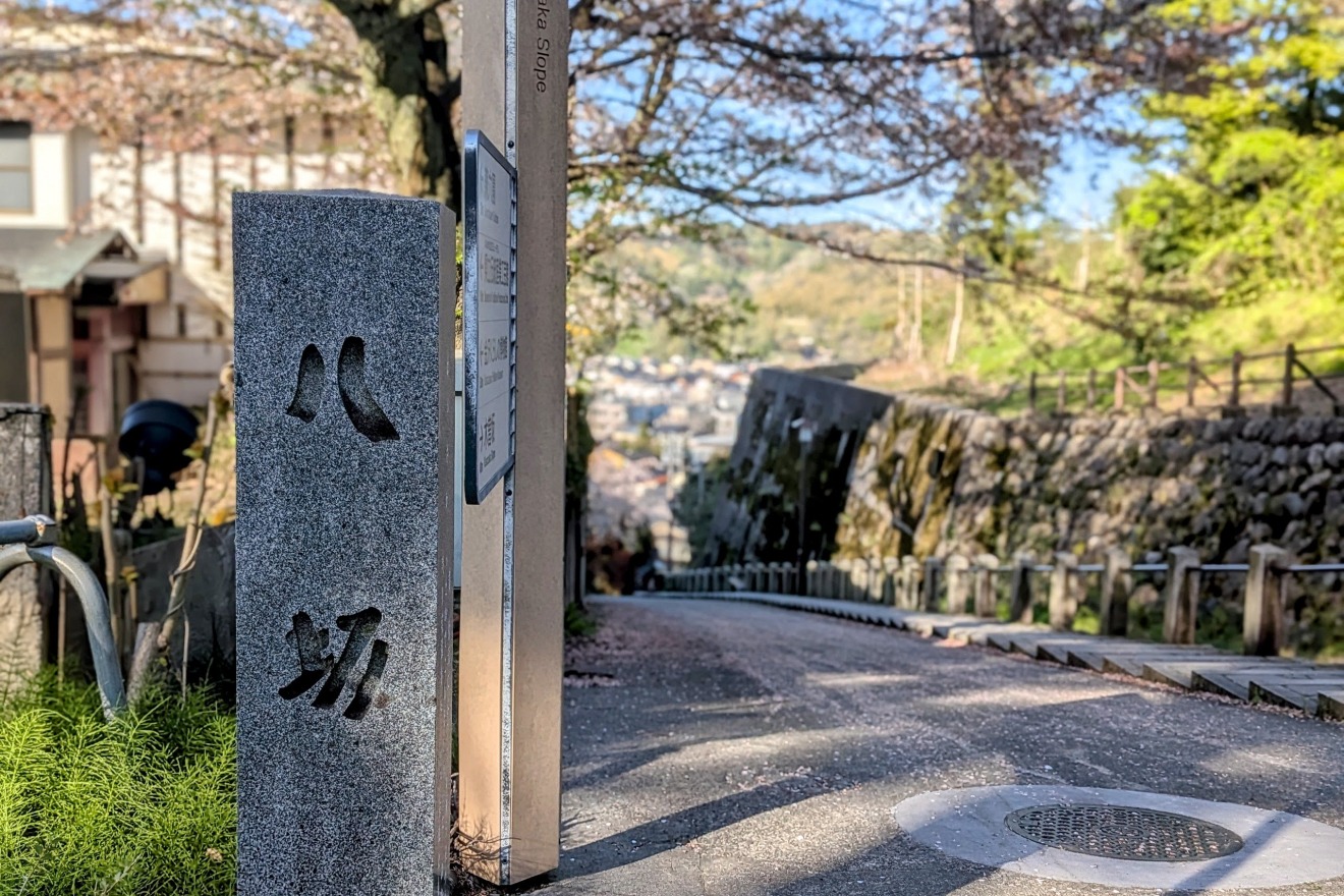
Yome-zaka(The Bride’s Slope) — The Slope a Father Cut Through for His Daughter
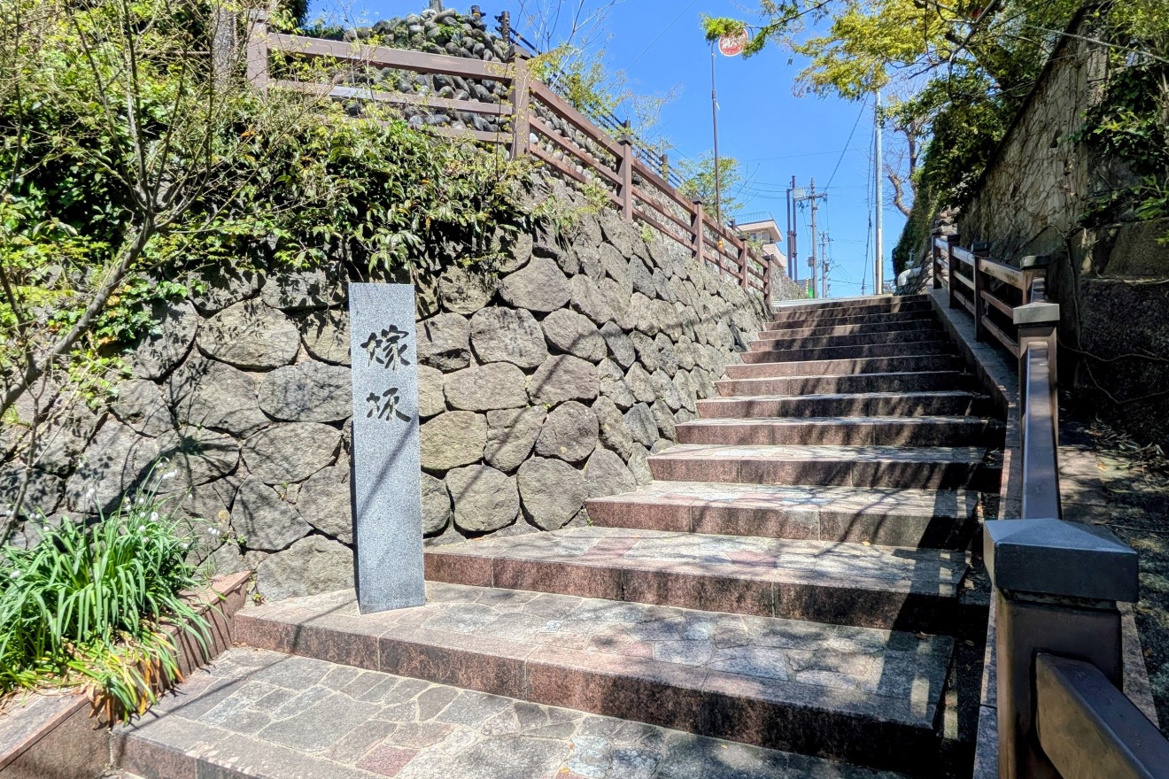
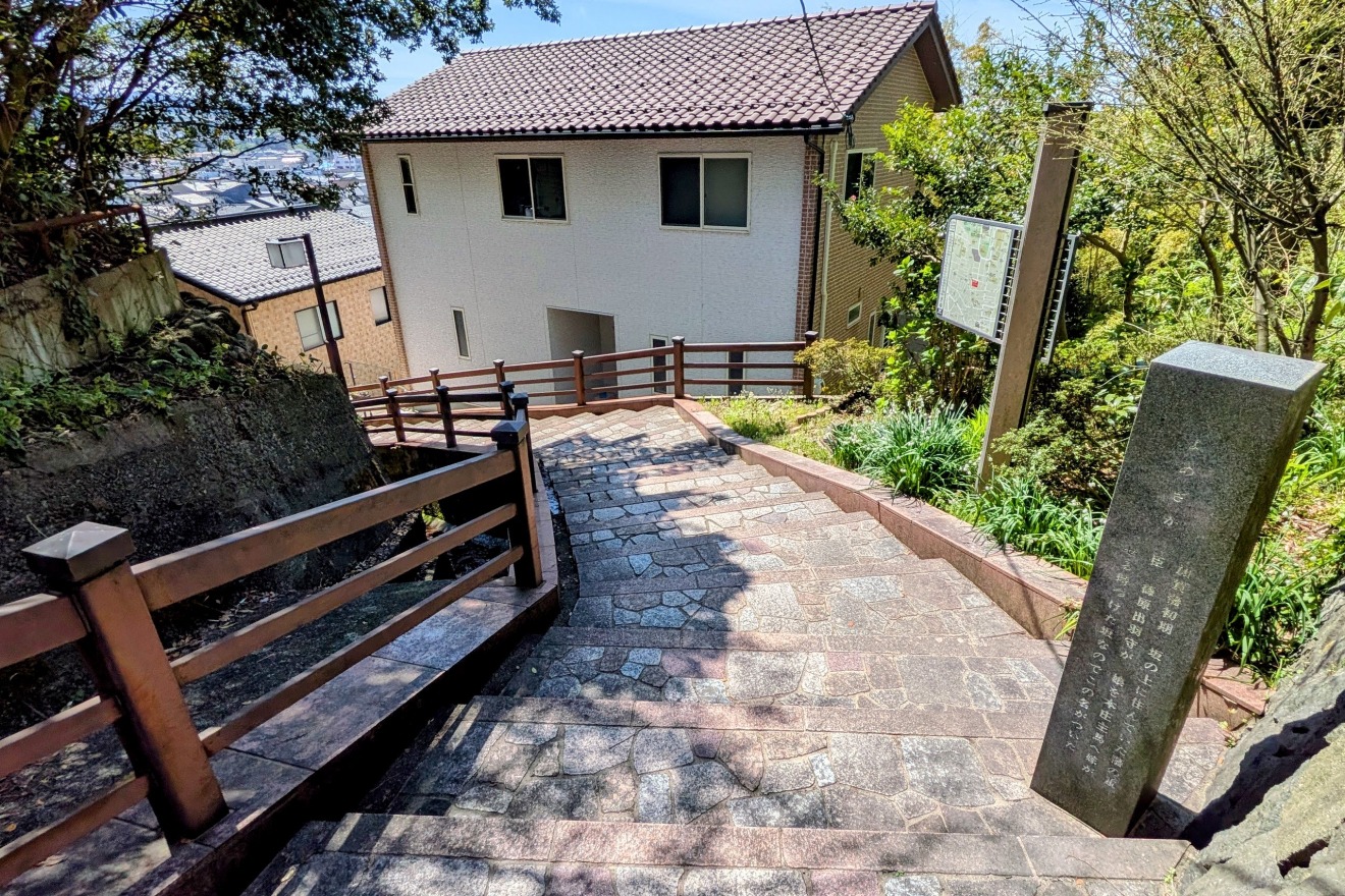
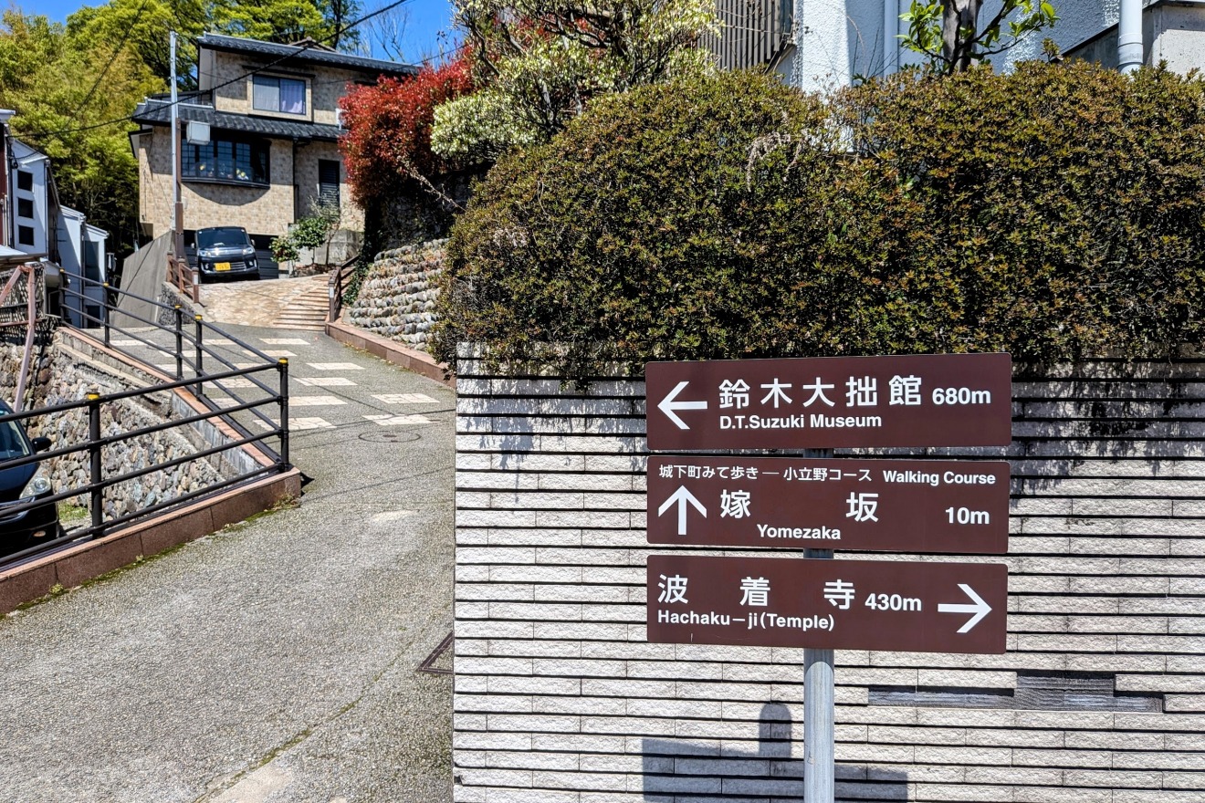
This slope is said to have been carved out at private expense by Shinohara Dewa-no-kami, a retainer of the Kaga Domain, so that his daughter — who was marrying the commander of an arquebus unit living at the foot of the cliff — would have an easier path.
Rather than accepting the steep terrain as an obstacle, a father reshaped the very landscape out of love for his child. That private, human story became a place name, and the path is still used as an everyday route today. In that continuity lives a depth of history that is quintessentially Kanazawa.
The name "Dewa-no-kami" lives on in the present-day district name "Dewa-machi."
Topography Data:
・Top of Yome-zaka: approx. 49m elevation
・Bottom of Yome-zaka: approx. 32m elevation
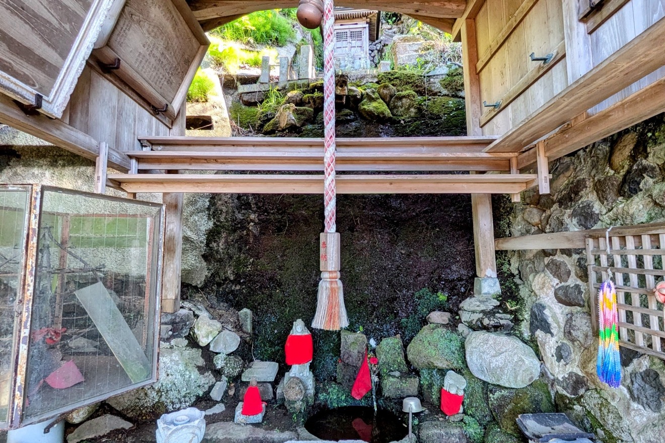
The Stone Walls of Kyoonji Temple — A fortress-like river terrace
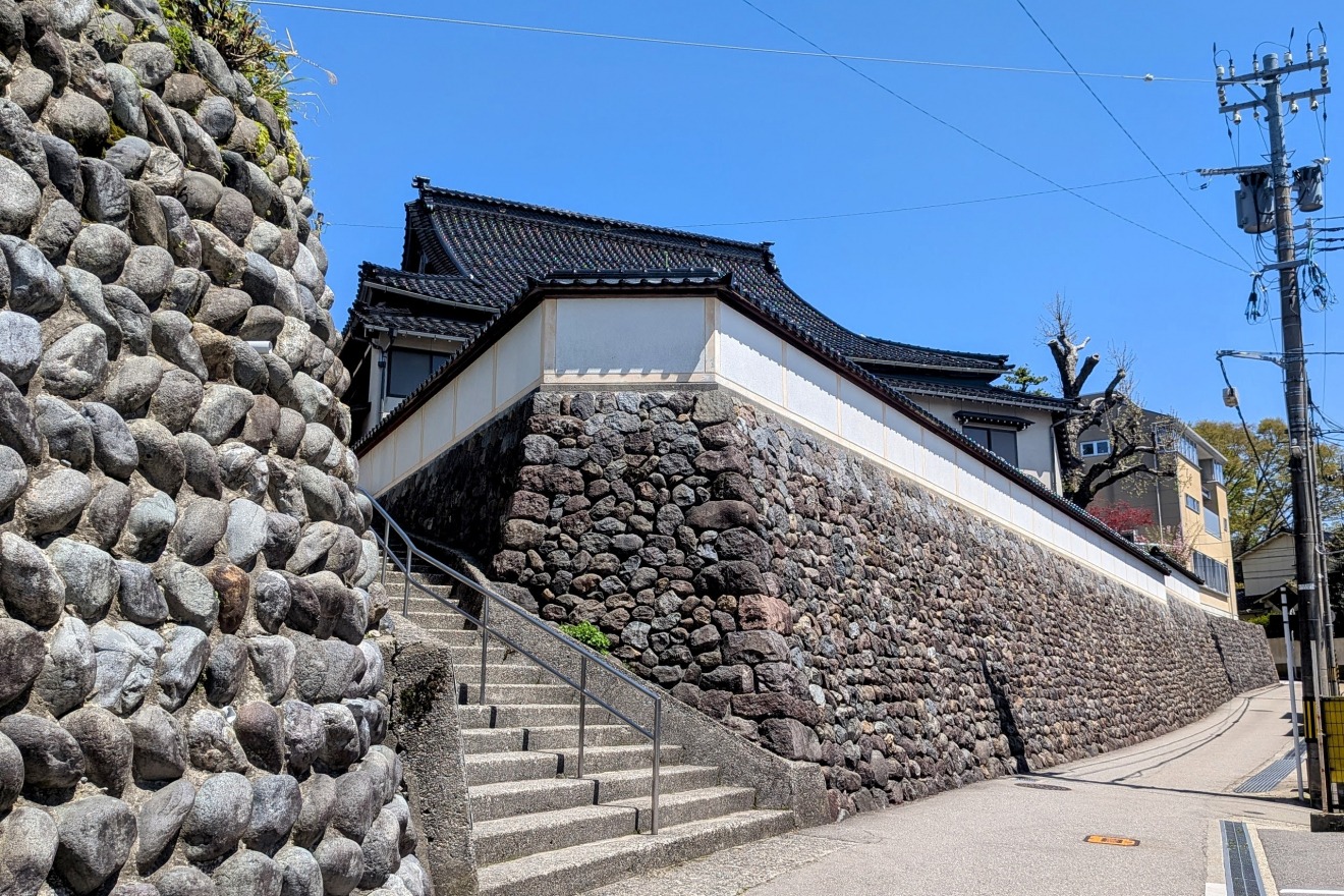
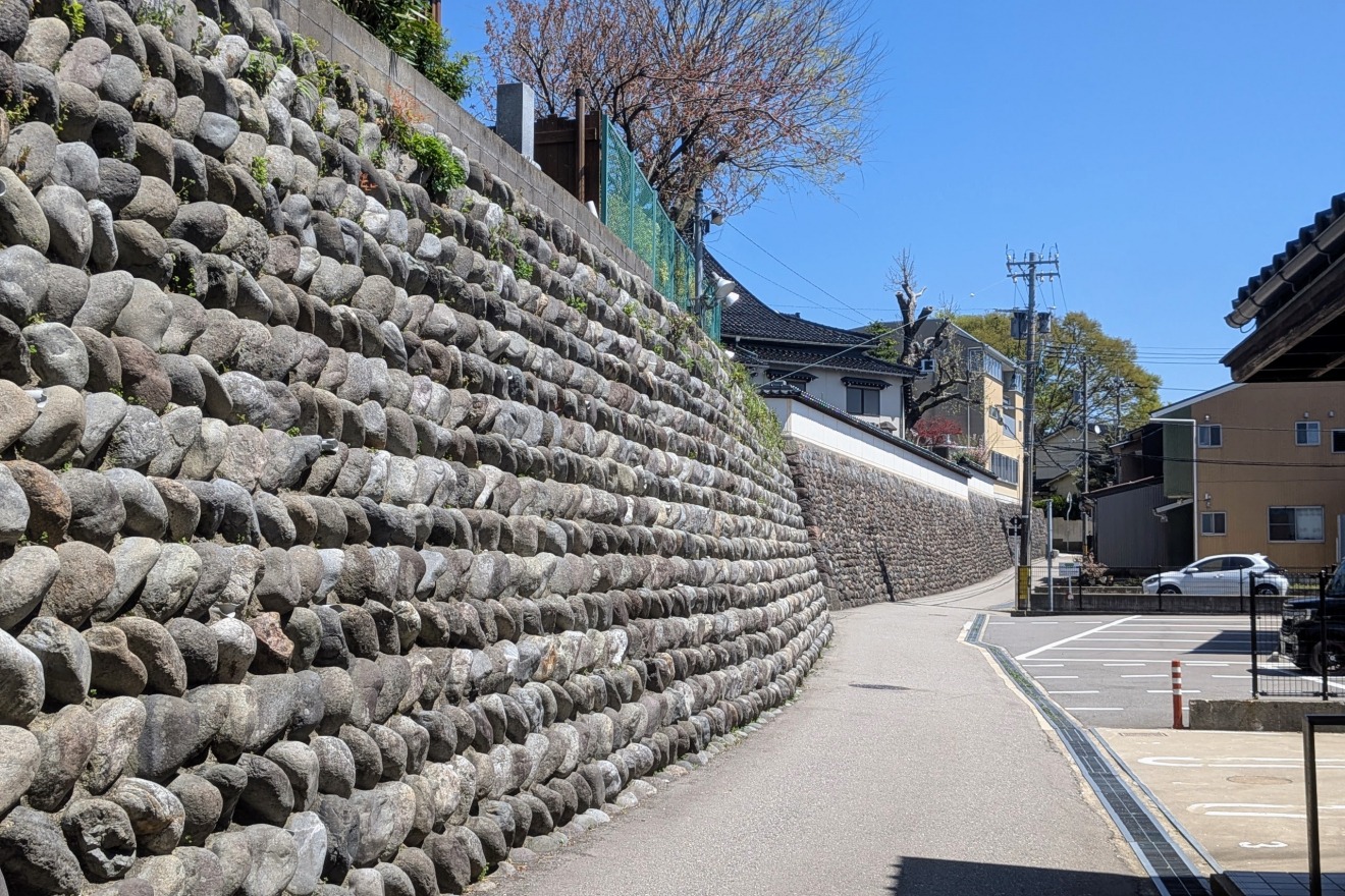
Perched at the very edge of the terrace, Kyoonji Temple is a remarkable example of natural topography harnessed to its fullest defensive potential.
The towering stone walls were built by incorporating the terrace cliff itself as part of the structure. Viewed from below, the sheer, imposing "wall" feels less like a temple and more like a castle fortification.
Topography Data:
・Base of Kyoonji stone wall: approx. 51m elevation
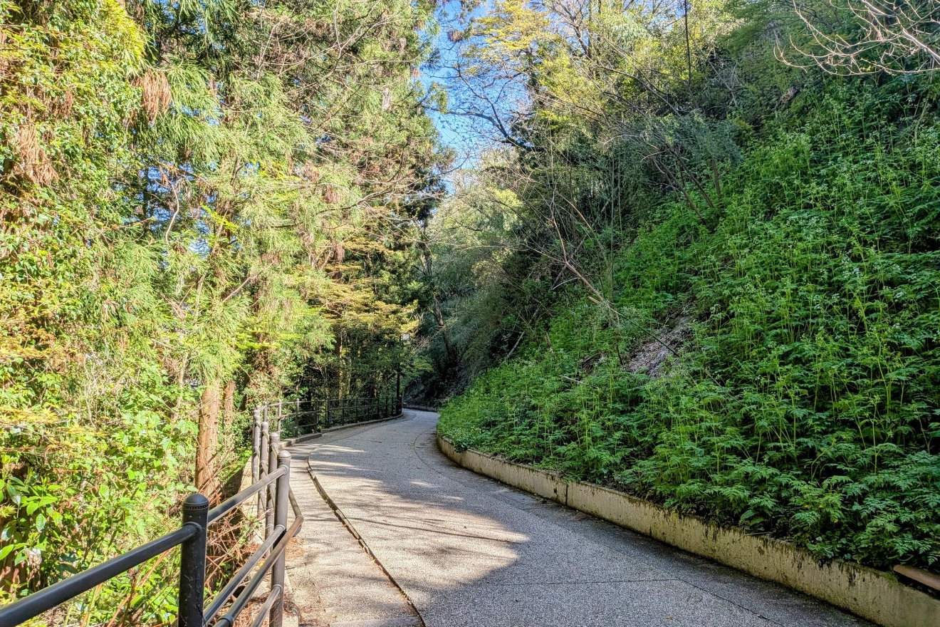
Nijunin (Twenty-Man)Slope and the valley carved by the Kantaro River
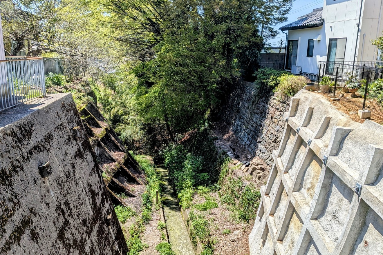
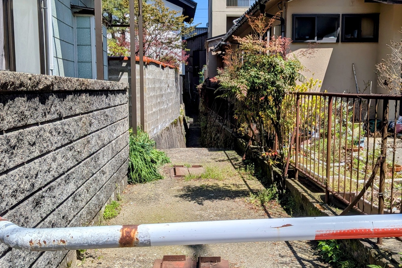
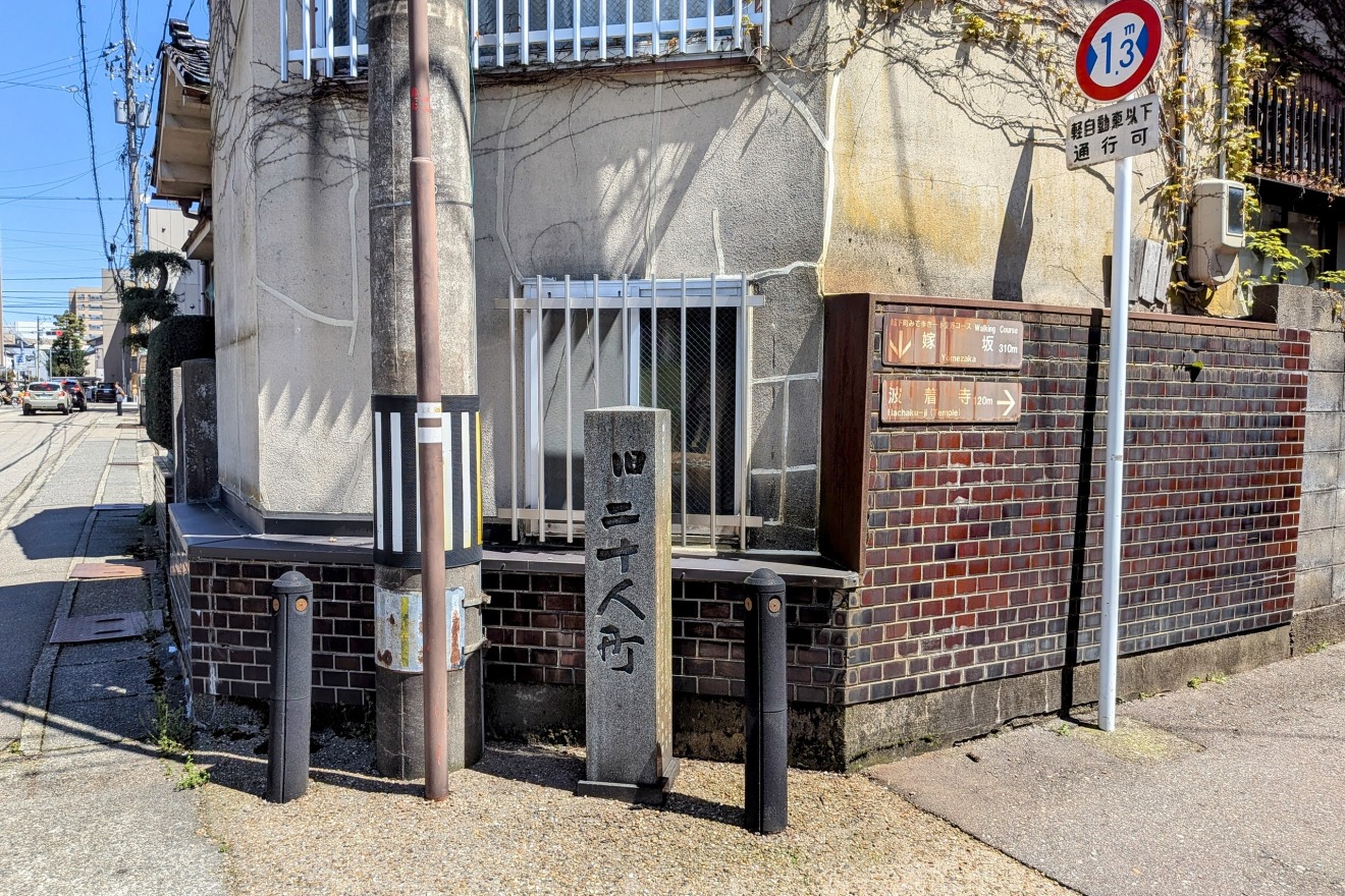
This area was known as "Kodatsuno Nijunin-machi" (Twenty-Man Quarter of Kodatsuno) in the Edo period, taking its name from the twenty arquebus foot soldiers who were stationed here.
Just steps away in an ordinary residential neighborhood, the valley carved by the Kantaro River makes a sudden, dramatic appearance — a hidden ravine sculpted over centuries by flowing water. The Kantaro River is fed by natural springs and diverted channels from the Tatsumi Canal, creating an intricate interplay of water and terrain.
Hachakuji Temple — A legacy intertwined with the lord’s history
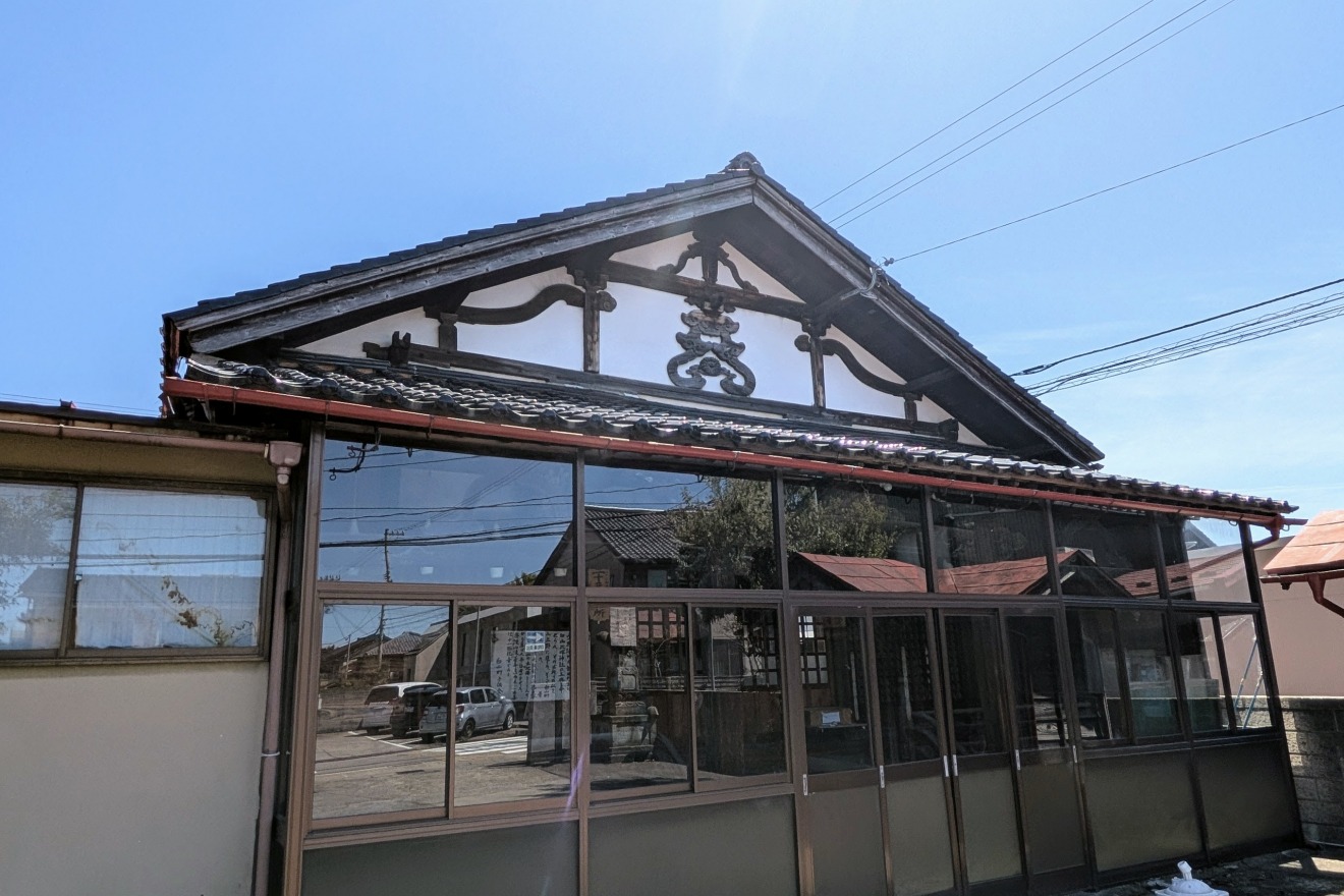
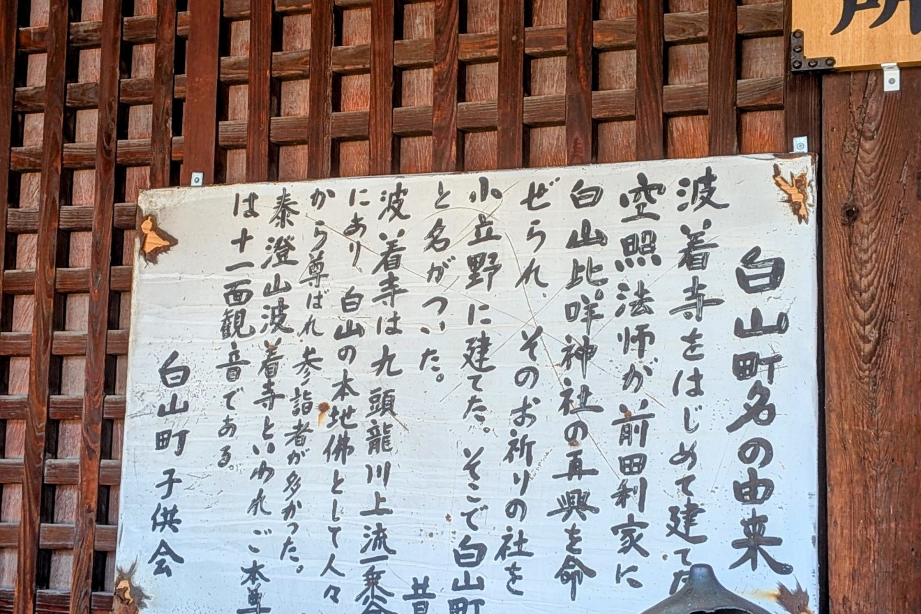
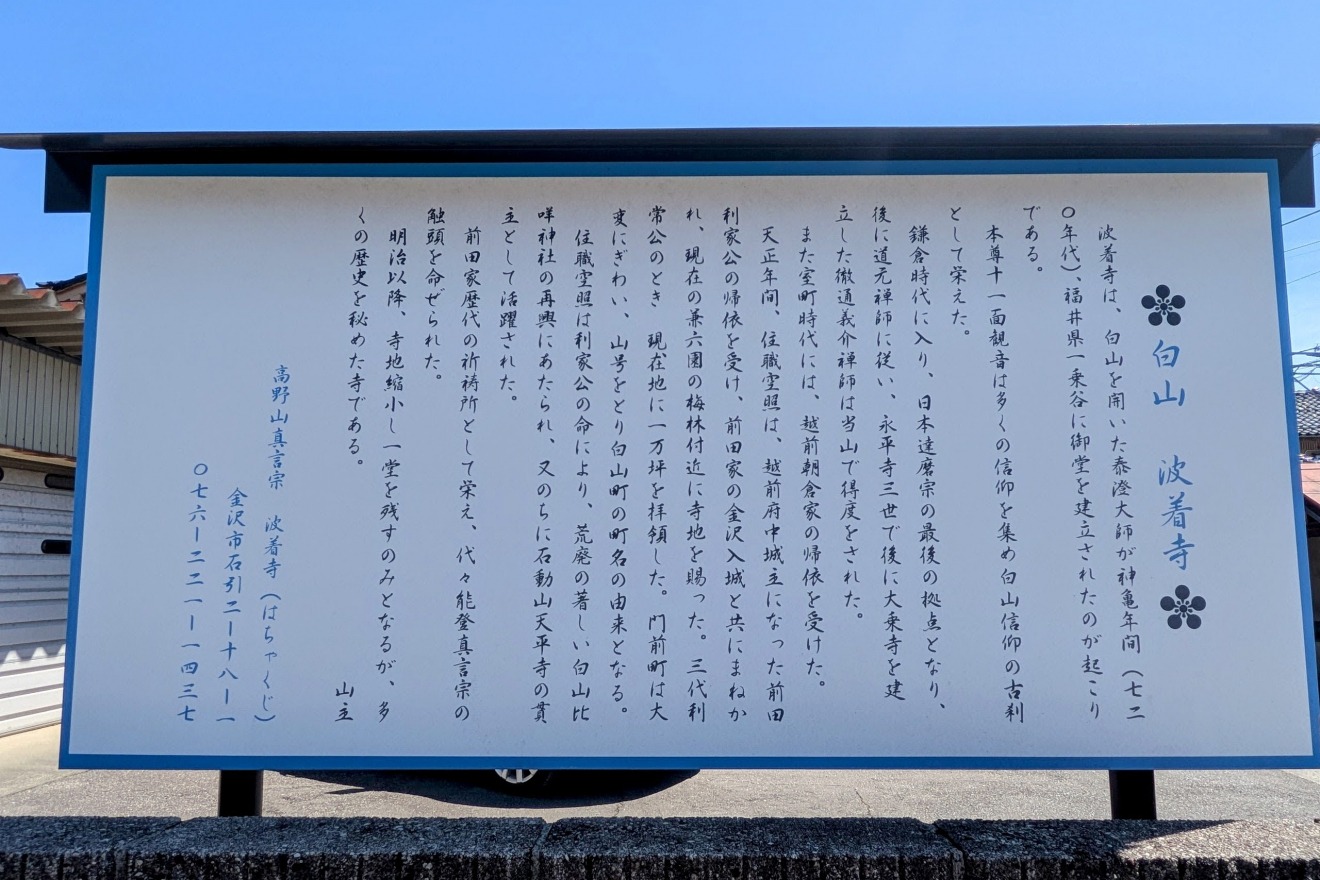
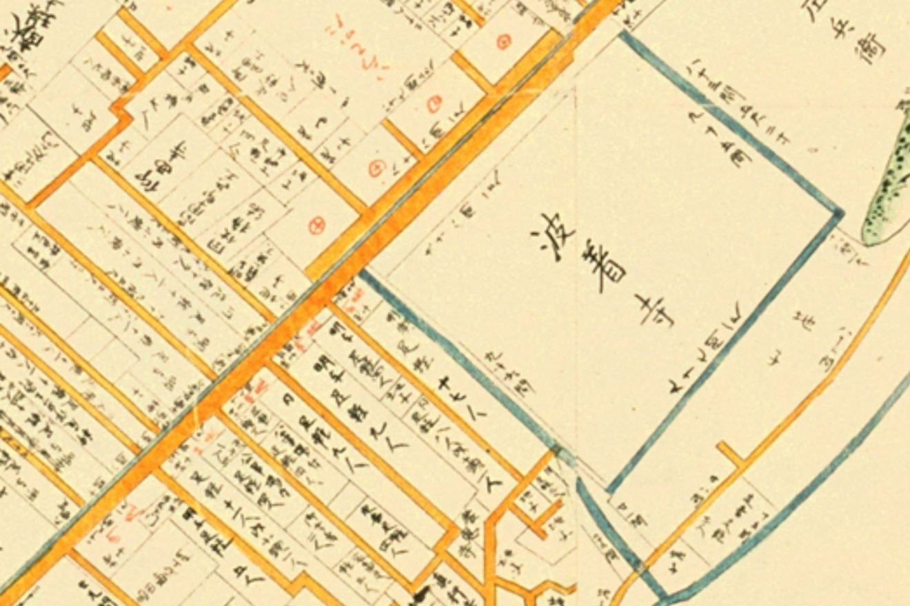
The origins of Hachakuji Temple trace back to the days when the founding lord MAEDA Toshiie was stationed at Fuchu in Echizen Province (present-day Fukui Prefecture), where the temple served as his place of prayer. It was later relocated to Kanazawa and has long been connected to the worship of Mt. Hakusan — one of Japan's three sacred mountains.
The slope in front of the temple is called "Hakusan-zaka(slope)," a name that preserves this deep spiritual connection. The history of prayer that walked alongside the Maeda clan lives on in the very name of the road.
Topography Data:
・Hachakuji Temple: approx. 57m elevation
Tentokuin & Nyoraiji Temples — Bonds with the Tokugawa Shogunate
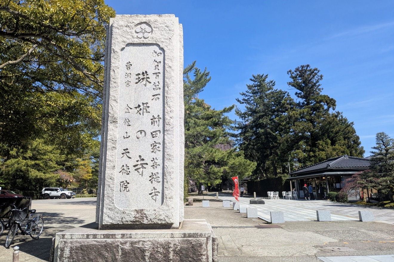
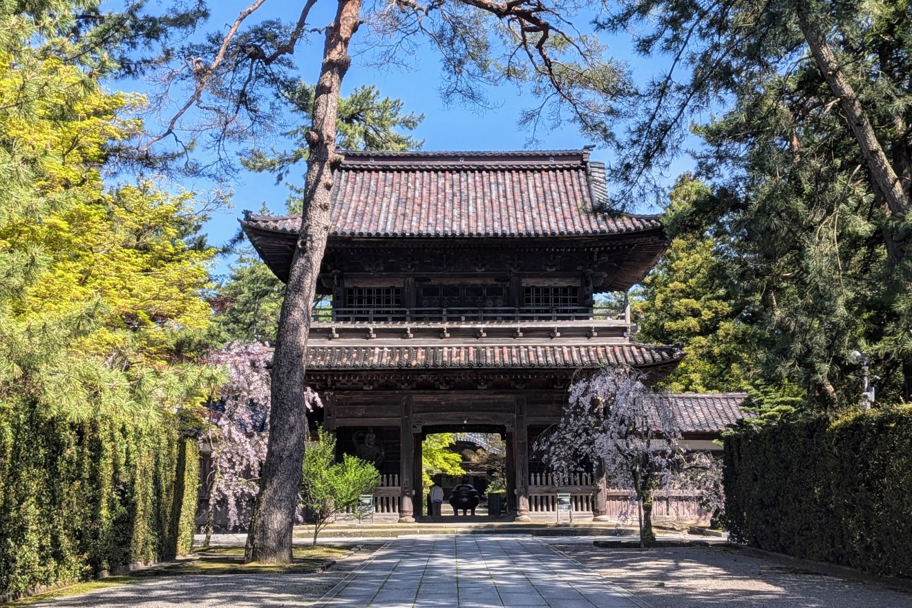
Tentokuin Temple was built by the third lord MAEDA Toshitsune to mourn his consort Princess Tama (Tamahime), the second daughter of the second Tokugawa Shogun, who passed away at the age of just twenty-four.
Note: The Tokugawa Shogunate was the military government that ruled Japan from 1603 to 1868, based in Edo (present-day Tokyo). The Maeda clan's marriage ties with the Tokugawa clan were a key part of maintaining political stability.
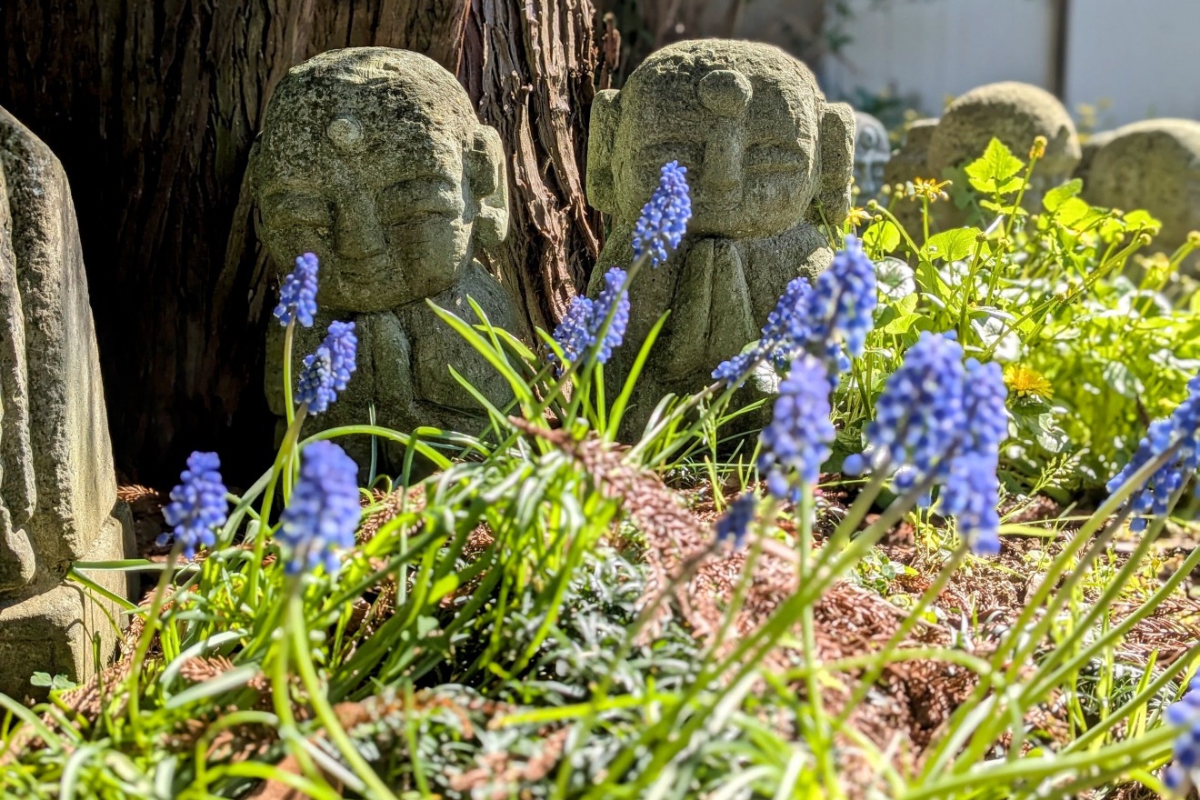
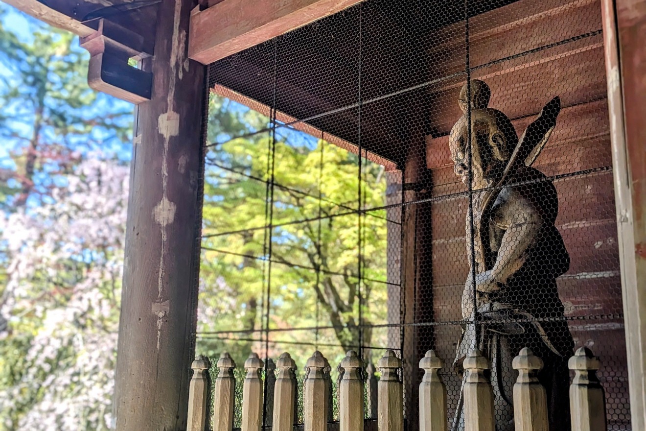
The grand temple complex sitting atop the plateau embodies the profound bond between the Kaga Domain and the Edo Shogunate. Nearby Nyoraiji Temple enshrines a memorial tablet of TOKUGAWA Ieyasu, the founder of the shogunate and the grandfather of Princess Tama , and its grounds are watched over by stone Buddha figures that quietly welcome visitors.
Topography Data:
・Tentokuin Temple Main Gate: approx. 62m elevation
・Nyoraiji Temple Main Gate: approx. 61m elevation
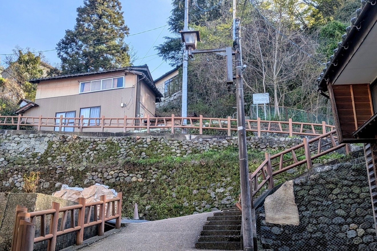
Tsuruma-zaka(slope) and the Former Kanazawa Prison — Where the Cliff Drops into the Valley

This site, now home to Kanazawa University's Tsuruma Campus, once housed the Kanazawa Prison.
As the dramatic drop of Tsuruma-zaka (Tsuruma Slope) behind the campus suggests, the location was surrounded by sheer cliffs at the edge of the plateau — a natural barrier that made escape extremely difficult, and an ideal site for a prison precisely because of its terrain.
The novelist ITSUKI Hiroyuki, one of Japan's most celebrated postwar authors, is known to have lived near this site in his younger years. Walking here, one can sense the layered histories — prison, literature, landscape — compressed into a single place.
The slope descending toward Asahi-machi below is Tsuruma-zaka itself, where you can feel the dramatic topography as the plateau drops sharply into the valley. In the Edo period, poets and literati were drawn to the sweeping views from this spot, which they celebrated by naming the valley Tsurumaidani — "the valley where cranes dance." Today, the view is partly obscured by the growth of surrounding trees, but the steep, serene atmosphere still conveys both the ruggedness of the terrain and the elegance of its past.
Topography Data:
・Top of Tsuruma-zaka(slope): approx. 64m elevation
・Bottom of Tsuruma-zaka(slope): approx. 30m elevation
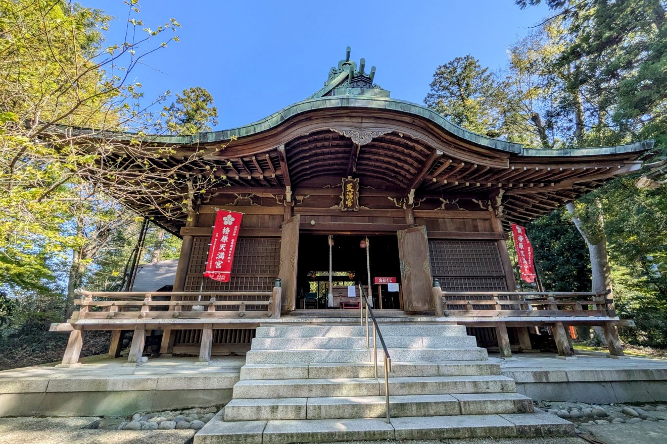
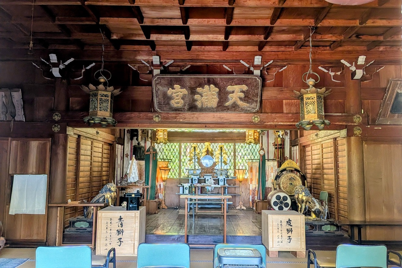
Tsubakihara Tenmangu Shrine — A Sacred Stronghold of History
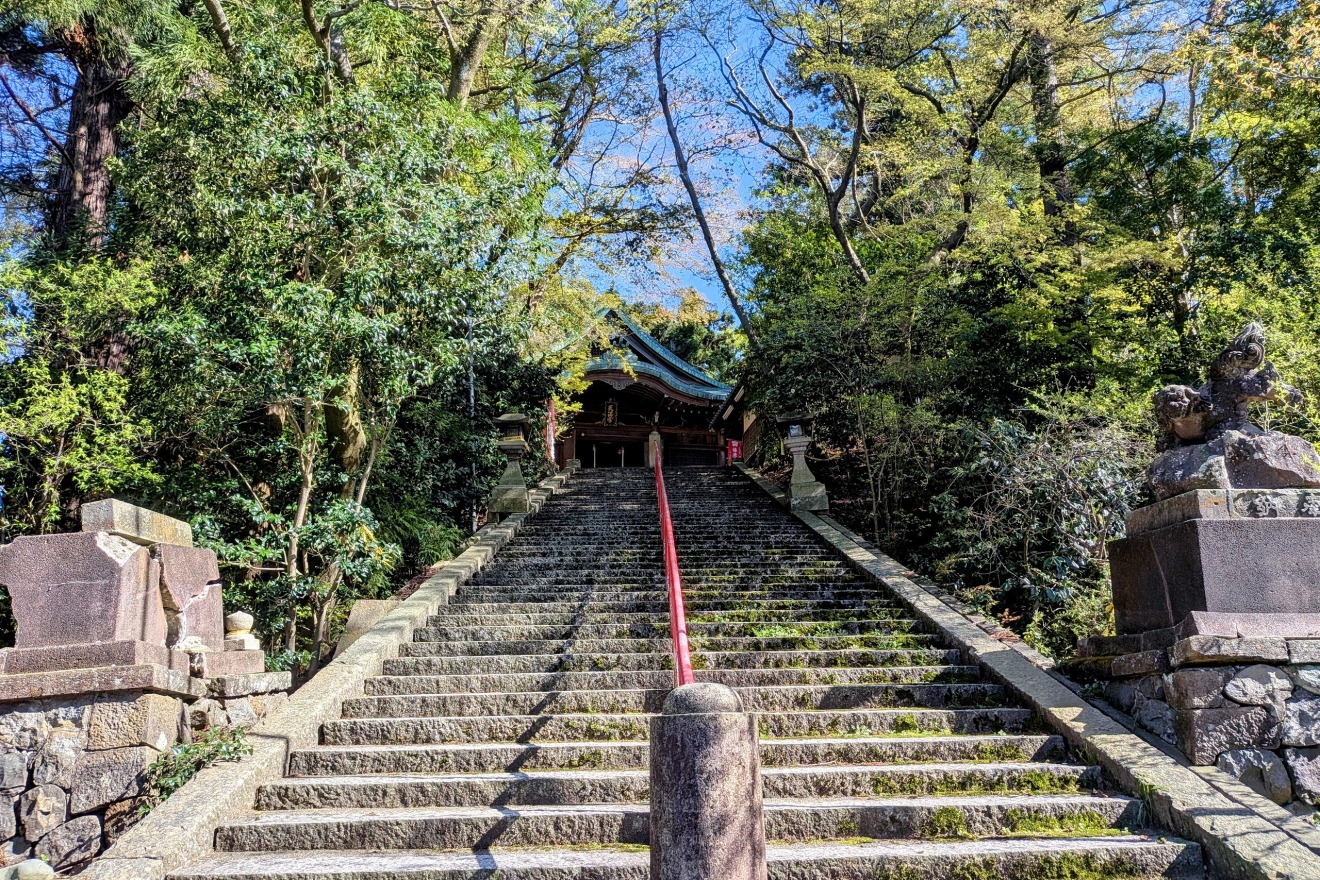
Since the Maeda clan's entry into Kanazawa Castle, this shrine has been revered as the ubusunagami※ — the guardian deity of the land — and stands as one of the "Five Shrines of Kanazawa" (Kanazawa Gosha).
※Note: An ubusunagami is the Shinto deity believed to protect the land where one is born and raised.
The "Five Shrines of Kanazawa" were five designated shrines specially protected and venerated by the Kaga Domain throughout the Edo period.
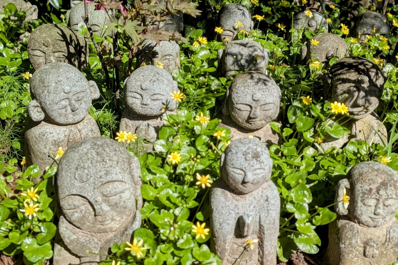
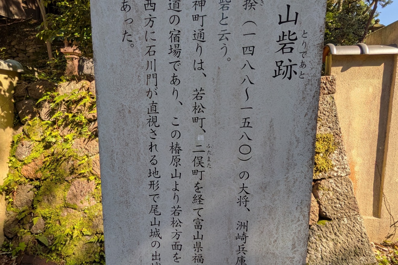
This site was once known as the "Tsubakihara Mountain Fortress" — a strategically vital stronghold. It served as a base for the Ikkō-ikki (a powerful league of Buddhist warrior-monks and peasants that controlled the Kaga region for nearly a century before the Maeda clan), from which signal fires were lit to communicate with Oyama Gobō — the temple complex that would later become Kanazawa Castle. Facing directly toward the Ishikawa-mon Gate of the castle, it also played a critical role as an outer fortification of Kanazawa Castle.
The shrine precincts, dedicated to Sugawara no Michizane — Japan's revered deity of scholarship — sit high on the plateau's edge, commanding sweeping views of the townscape along the Asanogawa River below. The steep slopes and dramatic drop of the river terrace visible from here tell the story of a place that once served as a natural fortress guarding both the highway and the castle town.
Topography Data:
・Tsubakihara Tenmangu Shrine (main hall): approx. 39m elevation
・Bottom of shrine stairway: approx. 28m elevation
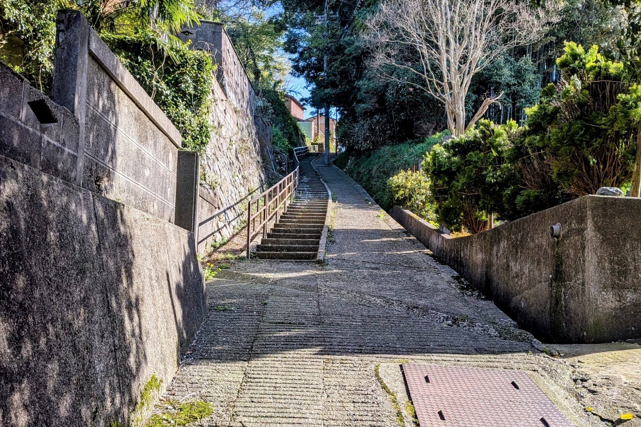
Uma-zaka(Horse slope) — An Ancient Path Descending from the Plateau to the lowerlands
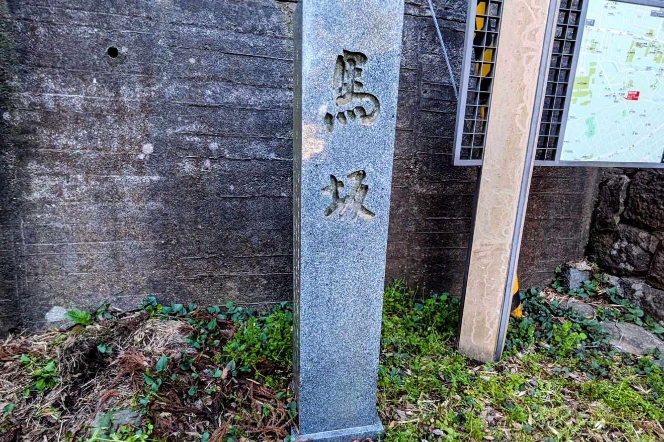
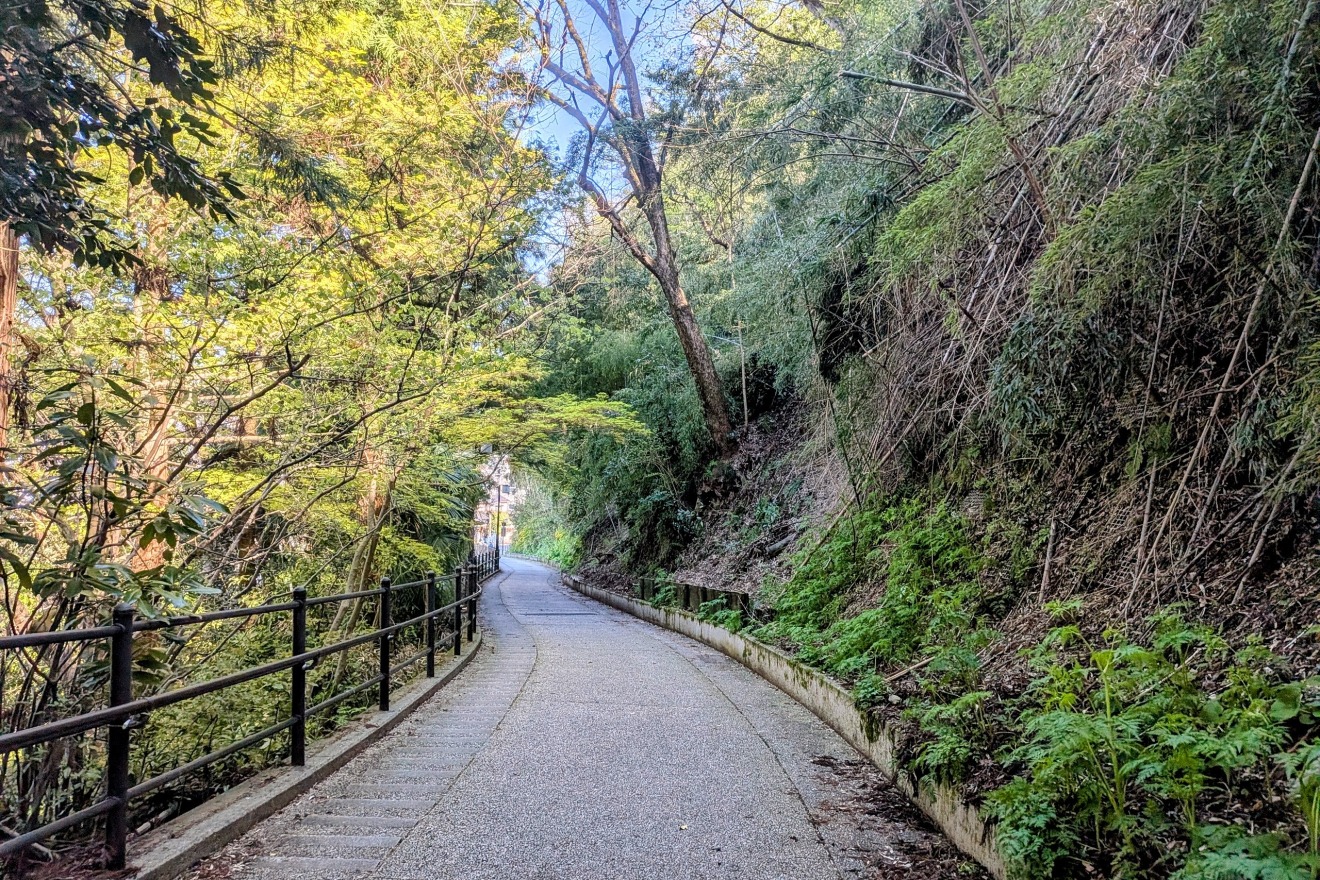
This slope, descending from the Kodatsuno Plateau toward the Asanogawa River, is said to have received its name — "Horse Slope" (Uma-zaka) — because farmers from the village of lowerlands would lead their horses up this path to gather grass on the plateau. Its many turns also earned it the alternate name "Six-Bend Slope" (Muttsu-magari-zaka).
Partway down the slope stands a small Fudōson — a stone guardian figure enshrining Fudō Myōō, a Buddhist deity believed to protect people from evils — which has watched over those passing by since ancient times.
Take your time on the descent, savoring the changes in gradient and the shifting townscapes that appear around each bend.
Topography Data:
・Top of Umazaka slope: approx. 47m elevation
・Bottom of Umazaka slope: approx. 29m elevation
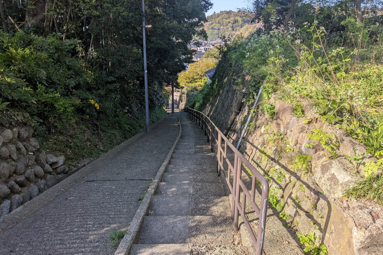
Kiso-zaka(slope) — A Quiet Hidden Path Beside the Maeda Clan's Most Sacred Temple
A Secret Passage Along the Ancestral Temple of the Lords of Kaga
Hōenji Temple was founded in 1583 by MAEDA Toshiie — the founding lord of the Kaga Domain — shortly after his entry into Kanazawa Castle. To establish it, he invited a revered Buddhist monk to whom he had been deeply devoted since his earlier years in Echizen Province (present-day Fukui Prefecture). It stands as the foremost bodaiji※ — ancestral family temple — of the Maeda clan, enshrining the memorial tablets (ihai) of successive domain lords across the generations.
※Note: A bodaiji is a Buddhist temple that serves as a family's principal place of ancestral worship, responsible for performing memorial rites and maintaining the family graves across generations. For a ruling clan, it held deep spiritual and political significance.
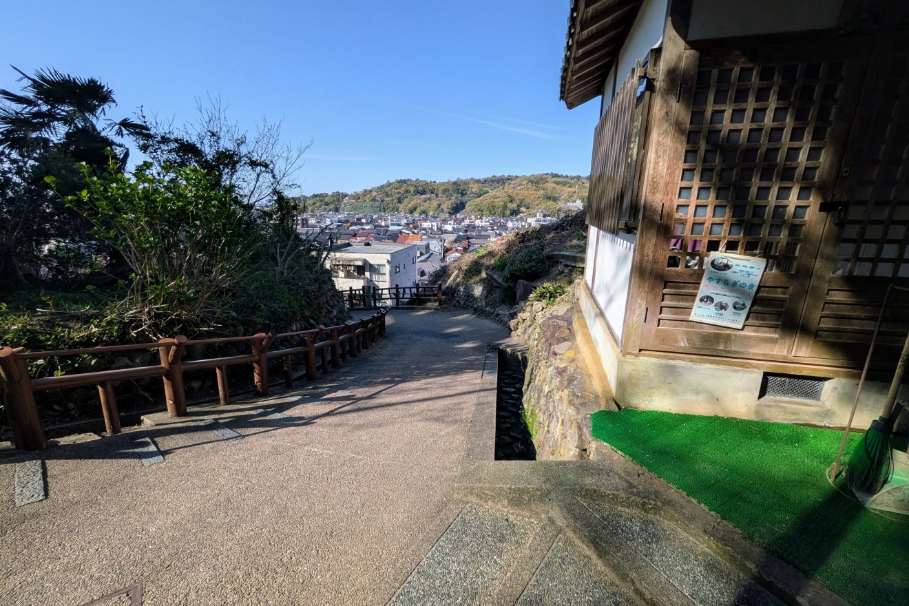
Slipping quietly away from the rear of this sacred precinct is "Kiso-zaka" — a hidden path that leads to the back gate of Hōenji Temple. Because of this connection, it has long been known by the alternate name Uragomon-zaka: the "Back Gate Slope."
Step onto this tree-canopied path, and the urban world of Kanazawa simply falls away. A profound stillness envelops you — the kind that makes it hard to believe a city lies just beyond the treeline. Here, beside a sanctuary untouched by the noise of modern life, you are free to walk alone and lose yourself in the deep currents of history.
A hidden gem of a path, quietly waiting to be discovered.
Topography Data:
・Top of Kisozaka slope (upper plateau): approx. 49m elevation
・Bottom of Kiso-zaka slope (lower terrace): approx. 29m elevation
Hassaka(Eight Slopes) and the Five Temple Mountains of Hassaka (Eight Slopes)— A "Wall of Prayer and Defense" at the Foot of the Plateau
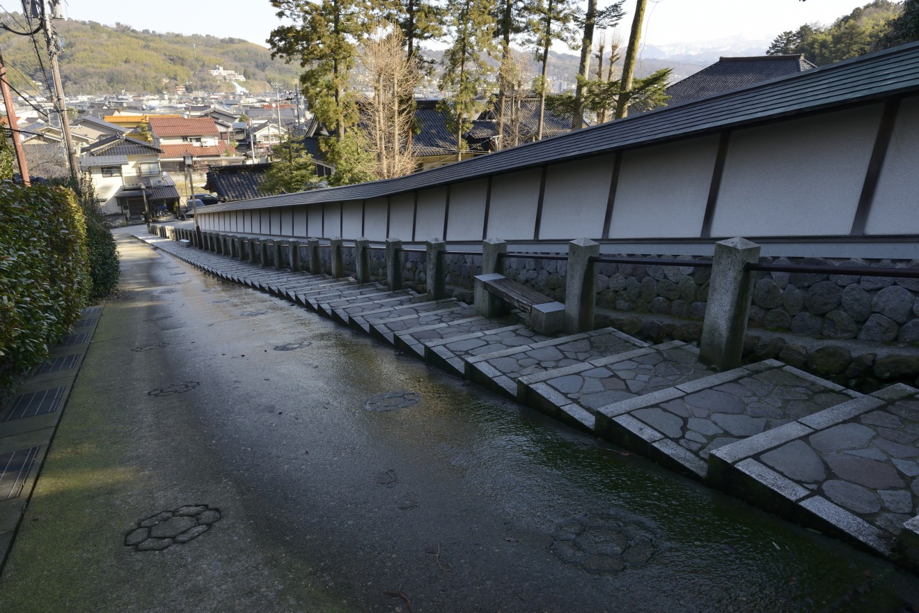
A Defensive Line of Faith, Compressed at the Plateau's Edge
"Hassaka" (Eight Slopes) descends dramatically in elevation from near the Kodatsuno entrance of Kenrokuen Garden down to the lower temple district. Legend has it that eight separate paths used by woodcutters once branched off from this area — the origin of the name.
The Five Temple Mountains of Hassaka.
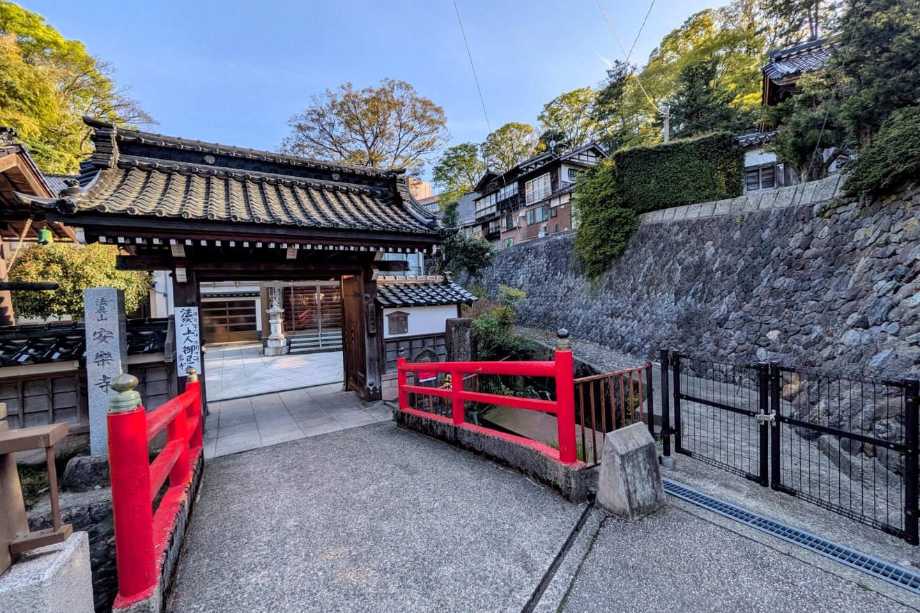
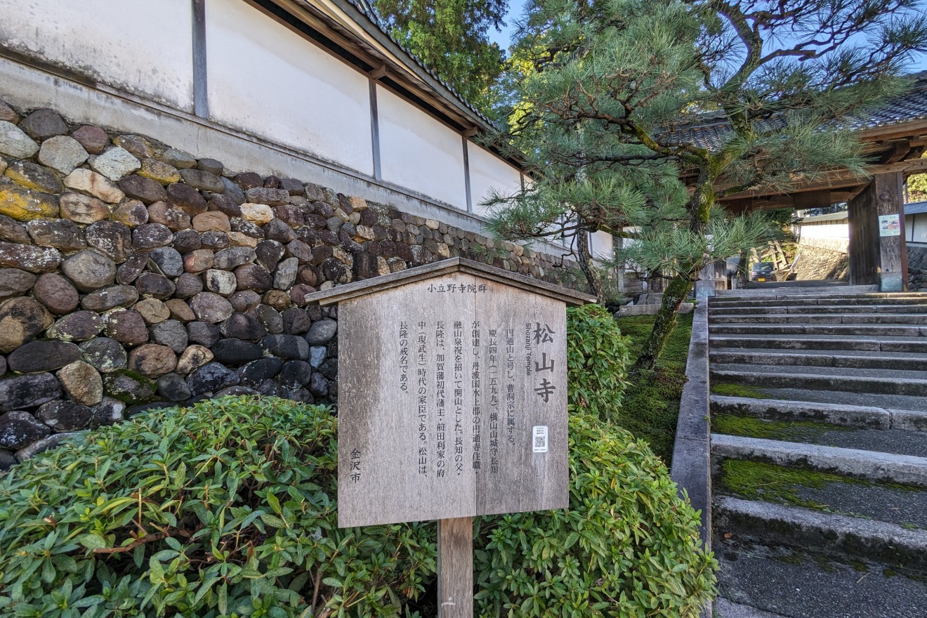
At the base of Hassaka, five temples line the foot of the plateau in close succession: Shōzanji, Youfukuji, Anrakuji, Unryūji, and Kakurinji — collectively known as the "Five Temple Mountains of Hassaka."
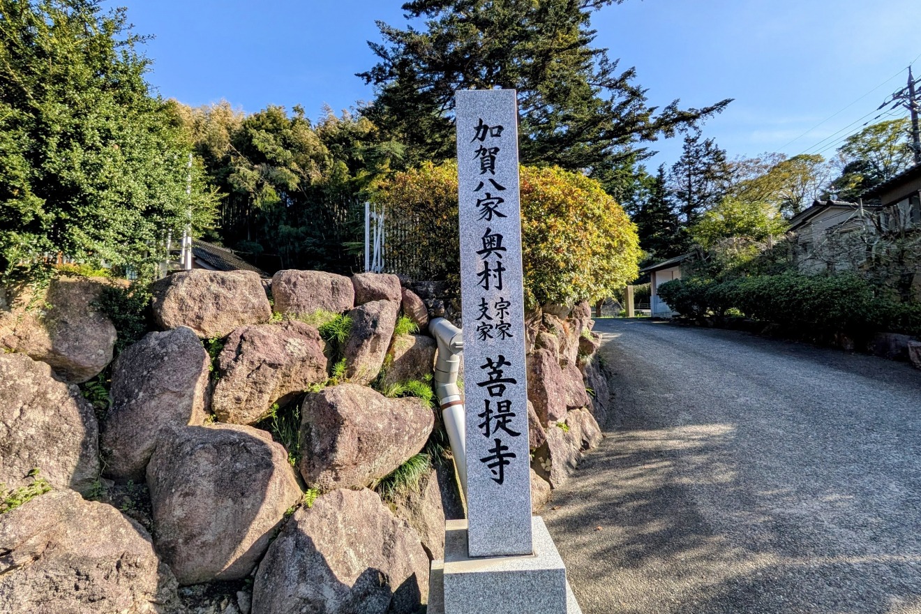
Their placement here was no coincidence. The family temples (bodaiji) of the Kaga Domain's most powerful senior retainers — including the Okumura and Yokoyama clans of the Kaga Hakka (the eight highest-ranking retainer clans) — were established at this precise location as part of a deliberate strategy.
The imposing temple buildings, high stone walls, and the sheer face of the terrace cliff all combined to form an "outer wall" blocking approach to the plateau.
If the Kodatsuno Plateau above served as a military high ground overlooking the castle town, then reinforcing its base with temples tied to the domain's most powerful families was itself an act of urban strategy. In this space — where faith, power, and defense were woven into one — the sophistication of the Kaga Domain's one-million-koku city planning is once again made vividly clear.
Topography Data:
・Top of Hassaka: approx. 51m elevation
・Bottom of Hassaka: approx. 27m elevation
Walk the slopes.
Read the land.
Kanazawa's deepest stories are written not in guidebooks, but in the rise and fall of the ground beneath your feet.